There are no more items in your cart
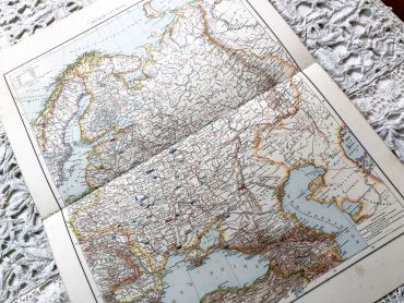

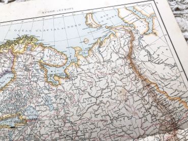
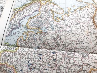
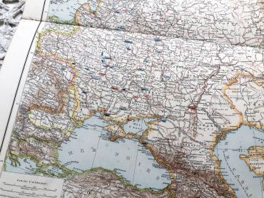
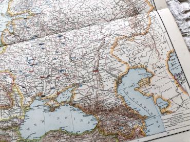
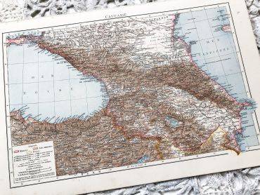
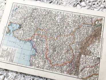
Huge vintage map of western Russia from a French atlas of the 1910s. This map on two pages measures 54 x 41 cm and forms the front of the document.
On the back you will find a smaller map of the Caucasian region (41 x 27 cm) and a map of Poland (41 x 27 cm) in the 1910s.
These maps show the world as it was in 1910s...
Except for digital products, all items are not reproductions, so there may be some wear and tear depending on age what makes it so charming.
Feel free to contact me if you have any questions.
The dimensions and weight of the items offered on this site are expressed in centimeters (cm) and in kilogram (kg).
Here is some information to help you convert them into your own measurement system:
- 10 cm is about 4 inches,
- 1 kg is about 2.2 pounds.

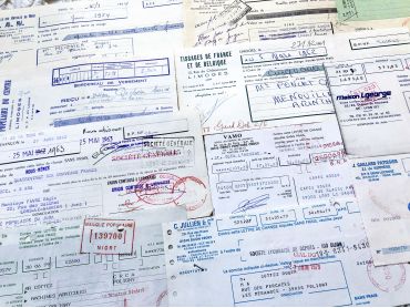
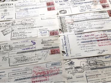
Set of 10 French bills of exchange from different periods (from 1950s to 1980s), paper sizes and textures.
The last photo shows the back of the bills of exchange.
These bills of exchange are financial instruments for loans between companies. Before the massive arrival of computers, these exchanges were carried out by hand as shown by these documents.
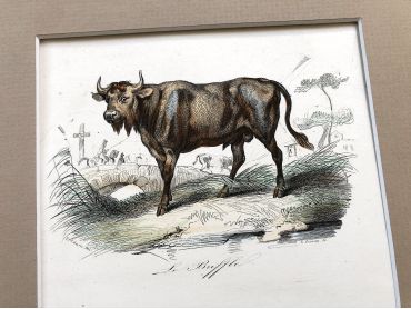
French engraving representing a buffalo and a bison by the drawer Victor Adam dating from the middle of the 19th century.
Jean-Victor Vincent Adam, born in Paris on January 28, 1801 and died in Viroflay on December 30, 1866, is a French painter and lithographer. He has illustrated numerous works and his drawings have been interpreted in engraving by Antoine François Gelée, Émile Giroux and Jean-François Pourvoyeur.
This engraving is probably the result of a reissue of the encyclopedia on wildlife of Buffon.
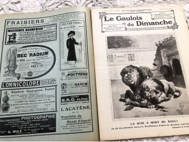
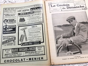
Large 24-page French weekly newspaper "Le Gaulois du Dimanche" of October 1909 with beautiful Art Nouveau cover, many articles about history, fashion, arts, literature, music, kitchen, and many engravings and photos.
Le Gaulois is a daily French literary and political newspaper founded on July 5, 1868. It became the property of press boss Arthur Meyer and was published until 1929 before being merged with the Figaro. Due to it large size, this magazine will be sent folded in half.
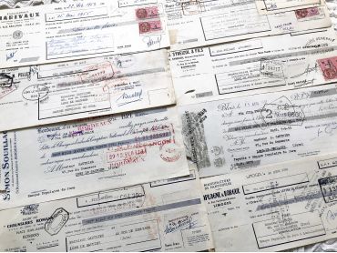
Set of 8 French bills of exchange from 1950s with tax stamps and rubber-stamps.
Note that several bills of exchange have a hole in the lower left corner: these bills of exchange had to be stapled to the corresponding bills and had to be detached more or less cleanly once the customer had paid the expected amount.
The last photo shows the back of the bills of exchange.
These bills of exchange are financial instruments for loans between companies. Before the massive arrival of computers, these exchanges were carried out by hand as shown by these documents.
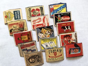
15 vintage matchbox labels - Advertising labels from 1930s to 1950s.
Labels are always glued to wood.
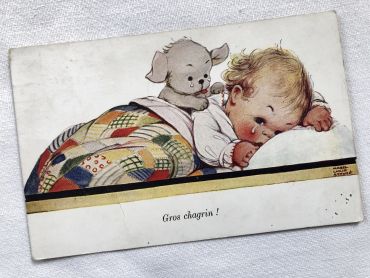
English postcard with an illustration of Mabel Lucie Attwell from 1930s
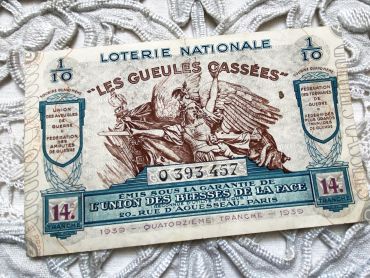
Huge French lottery ticket "Les gueules cassées" from 1939.
These lottery tickets were sold in the street or in small shops to help veterans.
Set of 8 French bills of exchange from 1950s with tax stamps and rubber-stamps.
Note that several bills of exchange have a hole in the lower left corner: these bills of exchange had to be stapled to the corresponding bills and had to be detached more or less cleanly once the customer had paid the expected amount.
The last photo shows the back of the bills of exchange.
These bills of exchange are financial instruments for loans between companies. Before the massive arrival of computers, these exchanges were carried out by hand as shown by these documents.
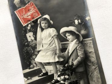
French postcard representing representing two children holding hands with the inscription "Bonne fête" from 1910s. Postcard sent in 1912.
In Europe and probably in other countries, it is tradition to wish a "bonne fête" to relatives and friends according to their first name and the calendar of saints. It is a tradition dating from the 16th century that lasted until the beginning of the 20th century and is gradually being lost.
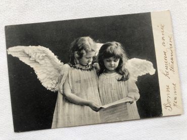
French postcard from the 1900s depicting two children with angel wings.
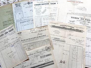
1920s - 1940s - 10 French commercial documents.
Large 24-page French weekly newspaper "Le Gaulois du Dimanche" of July 1909 with beautiful Art Nouveau cover, many articles about history, fashion, arts, literature, music, kitchen, and many engravings and photos.
Le Gaulois is a daily French literary and political newspaper founded on July 5, 1868. It became the property of press boss Arthur Meyer and was published until 1929 before being merged with the Figaro. Due to it large size, this magazine will be sent folded in half.
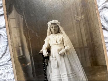
Old French photograph a young girl on the day of her First Communion in 1900s.
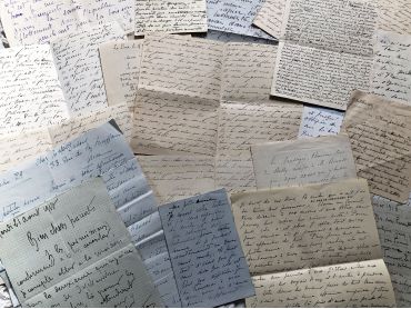
Set of 20 French vintage handwritten letters from 1910s with different handwritings, paper textures, formats. Some letters are not complete, some leaflets are missing.
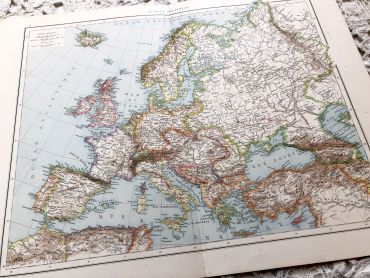
Huge vintage map of Europe from a French atlas of the 1910s. This map on two pages measures 54 x 41 cm and forms the front of the document.
On the back you will find a smaller map of the Pacific Ocean (41 x 27 cm) and a hypsometric physical map of Europe (41 x 27 cm) in the 1910s.
At that time Germany was very different from today and Poland was not an independent state.
These maps show the world as it was in 1910s...
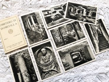
8 Italian postcards of the Catacombs of Domitilla in Rome from 1950s
Huge vintage map of western Russia from a French atlas of the 1910s. This map on two pages measures 54 x 41 cm and forms the front of the document.
On the back you will find a smaller map of the Caucasian region (41 x 27 cm) and a map of Poland (41 x 27 cm) in the 1910s.
These maps show the world as it was in 1910s...