-
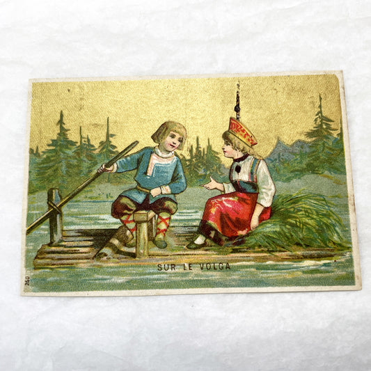
Late 19th - 2 Antique French Chromo Trade Cards - World Scenes - Voyage Themes - Rousseau Clothing Advertisement - Collectible Ephemera Set
Regular price €8,40 EURRegular priceUnit price per -
Late 19th - Victorian Fancy Card - Family Learning Alphabet - Customizable Motto Space - Vintage Advertising Ephemera
Regular price €3,00 EURRegular priceUnit price per -
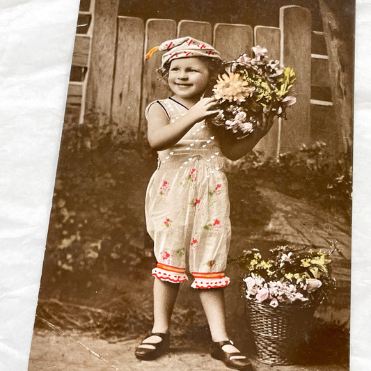
1910s - Vintage Postcard Little Girl Flowers French Sentiment - Antique Sepia Hand Colored Child Photo - Edwardian Era Ephemera Collectible
Regular price €4,80 EURRegular priceUnit price per -
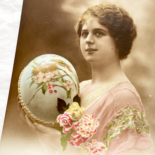
1910s - Antique French Easter Postcard - Young Woman Holding Decorated Egg - Painted Birds - Embossed Flowers - Vintage Holiday Greeting
Regular price €4,20 EURRegular priceUnit price per -
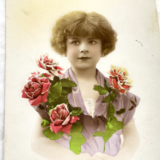
1920s - Vintage French Postcard - Young Woman with Roses - Bonne Année Greeting Card - Hand-Colored Antique Ephemera Collectible
Regular price €3,60 EURRegular priceUnit price per -
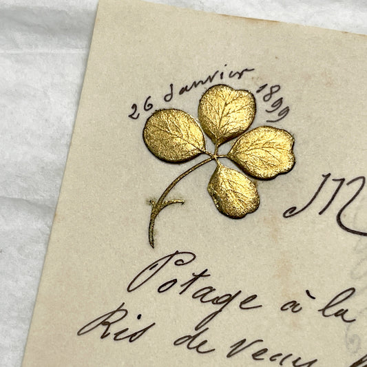
Late 19th - Exquisite 1899 French Menu - Hand-scripted Dining Card - Elegant Culinary Experience - Vintage Collectible
Regular price €4,80 EURRegular priceUnit price per -
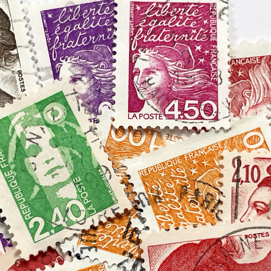
1990s - French Postage Stamps Collection - Marianne Effigy Designs - Liberté Égalité Fraternité Motto - Philately Lot - Vintage Stamps
Regular price €6,00 EURRegular priceUnit price per -
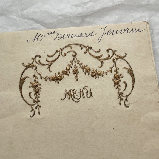
1900s - Antique French Menu Card - Elegant Hand-Written Dinner Party Souvenir - Formal Dining Experience Memorabilia
Regular price €3,60 EURRegular priceUnit price per -
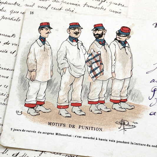
1900s - Humorous French Military Postcard - Sergeant Mihouchot Punishment Satire - Parisian Cafe Culture Memorabilia - Vintage Ephemera
Regular price €4,80 EURRegular priceUnit price per -
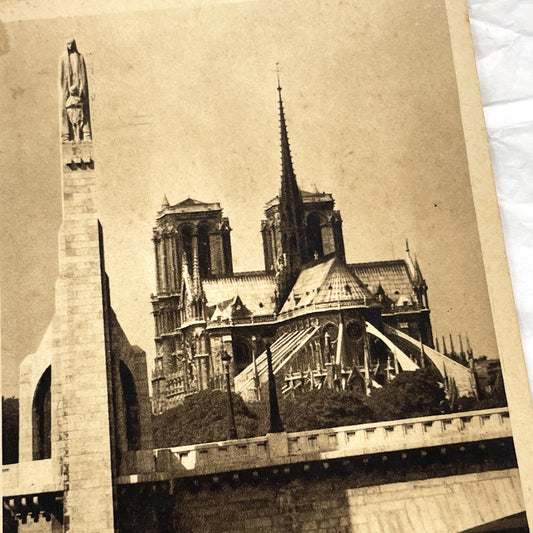
1930s - Vintage Notre Dame Cathedral Postcard - Paris France Architecture - Seine River Bridge View - Sepia Tone Print - Parisian Landmark
Regular price €5,40 EURRegular priceUnit price per -
1900s - Vintage European Postage Stamp Lot - Pre-1914 Collectible Philately - Historical Ephemera for Junk Journals And Crafts
Regular price €5,40 EURRegular priceUnit price per -
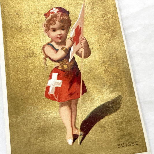
1900s - Vintage Chromo - Little Swiss Girl in Traditional Dress Holding Flag - Golden Background - Collectible Ephemera
Regular price €6,00 EURRegular priceUnit price per -
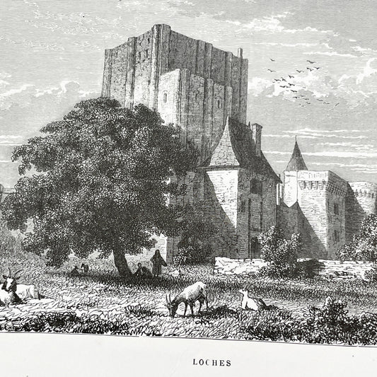
Late 19th - Historic Engraving of Loches Castle with Pastoral Scene - French Loire Valley Château Art - K. Girardet
Regular price €7,20 EURRegular priceUnit price per -
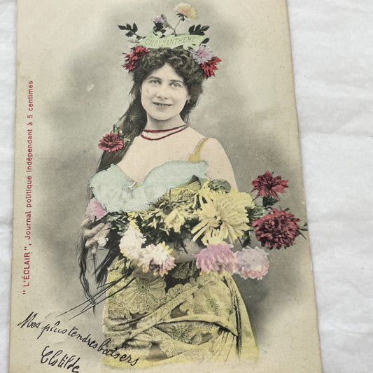
1900s - Langage Des Fleurs Chrysanthemum Postcard - Vintage French Ephemera - Antique Hand-Colored Woman Photo - L'Éclair Newspaper - Nancy
Regular price €4,80 EURRegular priceUnit price per -
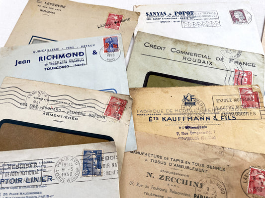
1950s - Lot of 20 Vintage French Business Envelopes – 1950s/1960s Ephemera for Junk Journals, Collage & Paper Crafts
Regular price €10,20 EURRegular priceUnit price per -
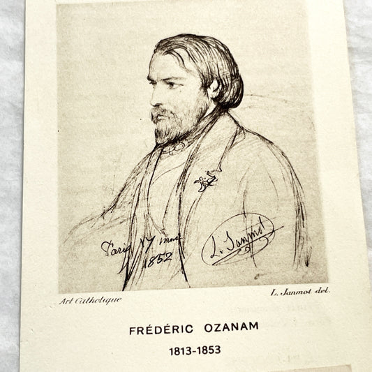
1910s - Frédéric Ozanam Relic Prayer Card - Society of Saint Vincent de Paul - Catholic Memorabilia - Vintage French Religious Item
Regular price €6,00 EURRegular priceUnit price per -
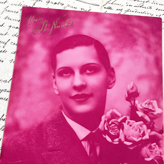
1920s - Vintage French Postcard - Portrait Of A Young Man Holding Roses - Actor - Magenta Color - 'Vive St-Nicolas' Inscription
Regular price €3,60 EURRegular priceUnit price per -
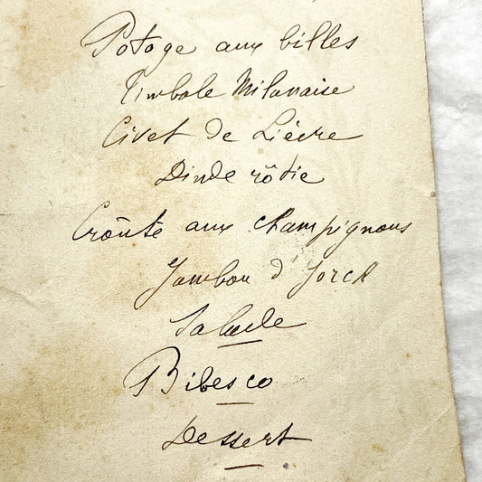
1890s - French Handwritten Menu Card - Elegant Culinary History - Vintage Dining Experience - December 1896 Festive Meal
Regular price €3,60 EURRegular priceUnit price per -
Late 19th - Vintage Advertising Fancy Card - Customizable Blank Space for Business Promotion - Illustrated Beetle and Flying Insects Design.
Regular price €3,00 EURRegular priceUnit price per -
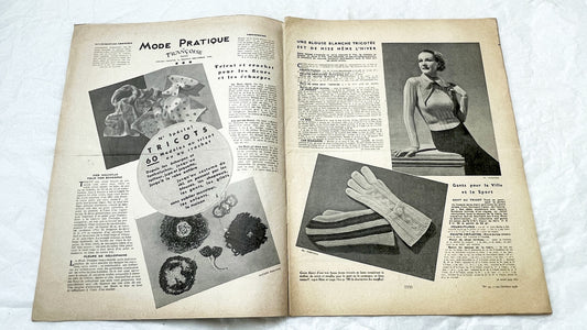
1930s - Mode Pratique Françoise Magazine - Vintage French Knitting Crochet Patterns - Classic 1936 Fashion - Special Issue Knitwear Designs.
Regular price €10,80 EURRegular priceUnit price per -
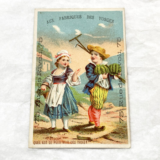
Late 19th - 2 Parisian Advertising Trade Cards - Vintage French Ephemera - Children Illustrations - Antique Store Promo - Paris Shopping
Regular price €6,60 EURRegular priceUnit price per -
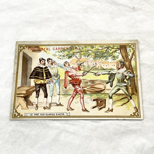
1900s - 2 Vintage French Thé Royal Advertising Trade Cards - The Royal Carpentier Opera Scenes - Collectible Ephemera Set
Regular price €7,20 EURRegular priceUnit price per -
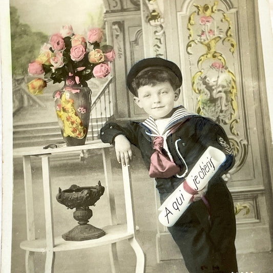
1910s - French Boy Sailor Postcard - Colored Sepia Photo - Antique Child Portrait - Edwardian Era Ephemera - Collectible Art Print
Regular price €4,80 EURRegular priceUnit price per -
1900s - La Vie Parisienne French Illustrated Magazine - Belle Époque Satirical Journal - Paris Fashion & Art Review
Regular price €9,60 EURRegular priceUnit price per -
1920s - Vintage French First Communion Menu - Maurice Halboust 1924 - Exquisite Embossed Religious Celebration Document Souvenir Collectible
Regular price €5,40 EURRegular priceUnit price per -
1910s - Elegant Edwardian Lady Portrait Postcard - Bonne Année Hand-Tinted French Art - Smiling Woman with Roses
Regular price €4,20 EURRegular priceUnit price per -
1950s - Vintage French Glitter Rose Postcard - Sainte Catherine Day Greeting Card - Floral Art - Collectible Ephemera - Flower - Pink Roses
Regular price €4,80 EURRegular priceUnit price per -
1930s - Vintage Paris Palais Du Trocadero Postcard - Historic French Architecture Landmark - Parisian Grandeur Memorabilia
Regular price €3,60 EURRegular priceUnit price per -
1910s - 3 Vintage Religious Cards - French Holy Communion Prayer Cards - Ornate Catholic Art - Ephemera for Junk Journals and Scrapbooking
Regular price €8,40 EURRegular priceUnit price per -
Late 19th - 3 French Advertising Cards with Parisian Trades - Lingerie - Woodcutter - Carrier - Collectible Ephemera
Regular price €12,00 EURRegular priceUnit price per -
Late 19th - Liebig Meat Extract Chromo Card - La Cigale et La Fourmi Fable Advertising - Vintage Ephemera Collectible
Regular price €4,80 EURRegular priceUnit price per -
1910s - Vintage French Christmas Postcard - Snowy Village Scene - Church and Figures - Embossed 'Joyeux Noël' - Collectible Ephemera
Regular price €4,80 EURRegular priceUnit price per -
1920s - Set of 1930s French Sheet Music – Folies Bergère Revue Songs – “Gloria”, “Au Temps des Fées”, “Merrily” – Maurice Hermite & Lucien Rémon
Regular price €4,80 EURRegular priceUnit price per -
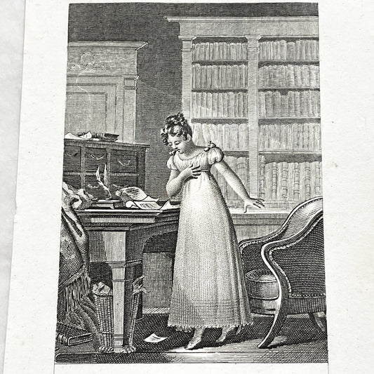
Early 19th - Dramatic Regency Era Engraving - Woman Reacting to a Will - French Historical Print - Emotional Interior Scene Art
Regular price €10,80 EURRegular priceUnit price per -
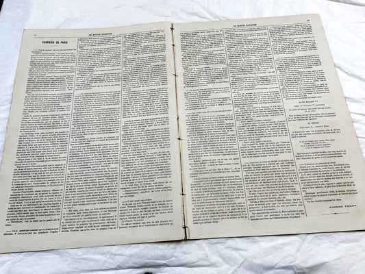
1860s - Stunning newspaper "Le monde illustré" with beautiful engravings - French newspaper from 1867 - 16 pages
Regular price €9,60 EURRegular priceUnit price per -
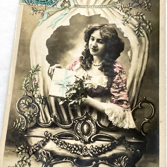
1900s - Antique French New Year Postcard - Elegant Woman with Gift - Holly Berries - Art Nouveau Style Greeting Card - Collectible Ephemera
Regular price €4,20 EURRegular priceUnit price per