There are no more items in your cart

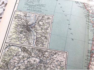
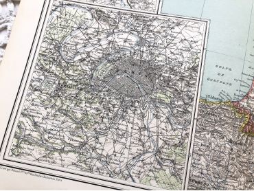
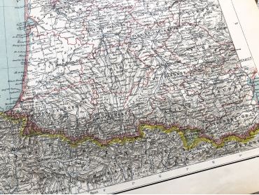
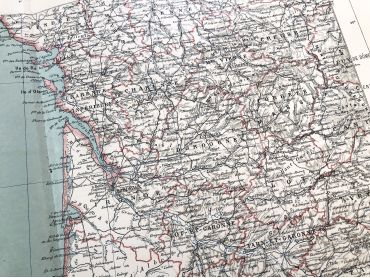
Large vintage map of South-East France and the cities of Paris and Bordeaux from a French atlas of the 1910s. This map on two pages measures 46 x 37 cm and forms the front of the document.
These maps show the world as it was in 1910s...
By buying this product you can collect up to
10
loyalty points
.
Your cart will contain total
10
points
that can be converted into a voucher of
€0.50
.
Except for digital products, all items are not reproductions, so there may be some wear and tear depending on age what makes it so charming.
Feel free to contact me if you have any questions.
The dimensions and weight of the items offered on this site are expressed in centimeters (cm) and in kilogram (kg).
Here is some information to help you convert them into your own measurement system:
- 10 cm is about 4 inches,
- 1 kg is about 2.2 pounds.

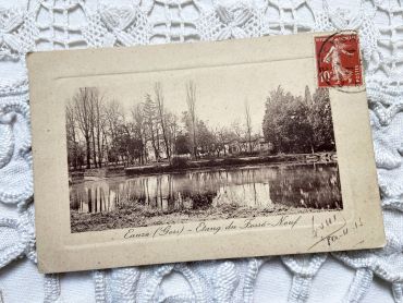
French postcard of the village of Euze in the South of France from 1910s.
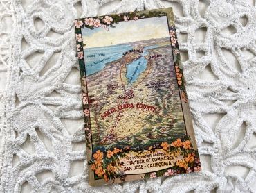
US postcard representing a map of California with Santa Clara and San Francisco cities from 1930s
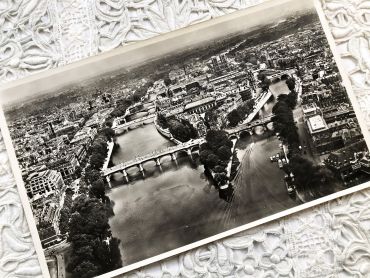
Huge aerial photography of Paris from 1950s
You will can see on the picture (in French): Notre-Dame, le Palais de Justice, la Sainte-Chapelle, l'ancien magasin La Samaritaine, les théâtres du Châtelet, l'Hôtel de Ville de Paris, le Jardin des Plantes, la Gare de Lyon, etc.
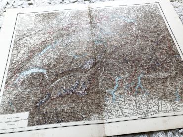
Huge vintage map of Switzerlan from a French atlas of the 1910s. This map on two pages measures 54 x 41 cm and forms the front of the document.
On the back you will find a smaller map of Sweden and Norway (41 x 27 cm) and a map of northern Italy (41 x 27 cm) in the 1910s.
These maps show the world as it was in 1910s...
Vintage French postcard with a bouquet of roses from 1950s.
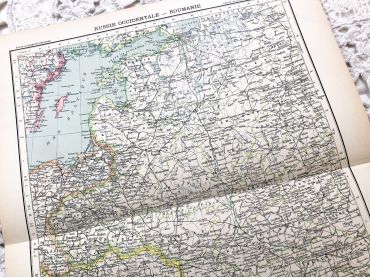
Large vintage map of Western Russia and Romania (and Poland, Bulgaria, etc.) from a French atlas of the 1910s. This map on two pages measures 46 x 37 cm and forms the front of the document.
These maps show the world as it was in 1910s...
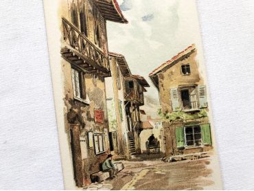
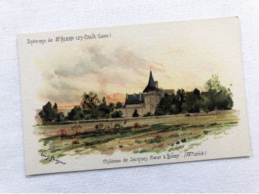
French vintage postcard of Saint-Alban-les-Eaux by the painter Louis Tauzin from 1900s.
Louis Tauzin, born July 21, 1842 in Barsac and died August 30, 1915 in Royan in 1915, is a French landscape painter and affichiste-chromolithographer. Between 1900 and 1910, Louis Tauzin painted a series of watercolours of spa towns (Saint-Alban-les-Eaux, Évian, Vichy) which were used as models for postcards.
More information at https://fr.wikipedia.org/wiki/Louis_Tauzin
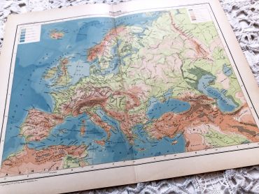
Large vintage map of Europe from a French atlas of the 1910s. This map on two pages measures 46 x 37 cm and forms the front of the document.
These maps show the world as it was in 1910s...
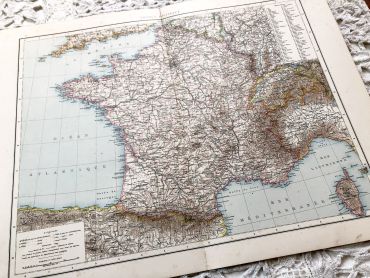
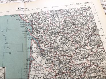
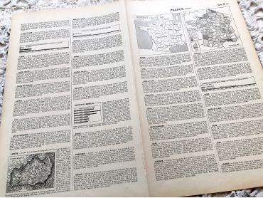
Huge vintage map of France from a French atlas of the 1910s. This map on two pages measures 54 x 41 cm and forms the front of the document.
On the back you will find a smaller map of the north-east of France and the Paris region (41 x 27 cm) and a map of the south west of France (41 x 27 cm) in the 1910s.
These maps show the world as it was in 1910s...
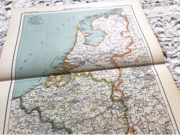
Large vintage map of The Netherlands from a French atlas of the 1910s. This map on two pages measures 46 x 37 cm and forms the front of the document.
These maps show the world as it was in 1910s...
French vintage postcard of Saint-Alban-les-Eaux by the painter Louis Tauzin from 1900s.
Louis Tauzin, born July 21, 1842 in Barsac and died August 30, 1915 in Royan in 1915, is a French landscape painter and affichiste-chromolithographer. Between 1900 and 1910, Louis Tauzin painted a series of watercolours of spa towns (Saint-Alban-les-Eaux, Évian, Vichy) which were used as models for postcards.
More information at https://fr.wikipedia.org/wiki/Louis_Tauzin
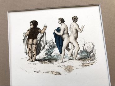
French engraving representing strange characters dating from the middle of the 19th century.
This engraving is probably the result of a reissue of the encyclopedia on wildlife of Buffon even if this engraving presents humans
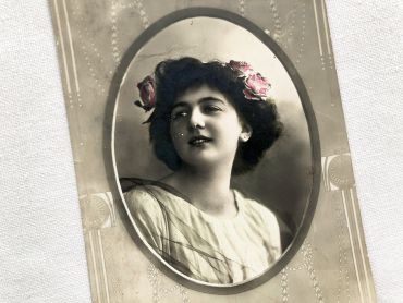
Swiss postcard of a young woman wearing flowers in her hair from 1900s.
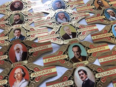
Sets of 11 large cigar bands - Tobacos Alvaro - Spanish brand of cigars - Serie Literatos - From 1970s
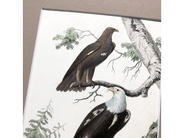
French engraving representing two types of eagles by the drawer Edouard Travies dating from the middle of the 19th century.
Édouard Traviès de Villers, born in Doullens on March 24, 1809, and died in Paris 5th on November 18, 18761, is a well-known animal painter, illustrator and lithographer. This engraving is probably the result of a reissue of the encyclopedia on wildlife of Buffon.
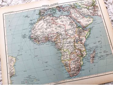
Large vintage map of the political Africa from a French atlas of the 1910s. This map on two pages measures 46 x 37 cm and forms the front of the document.
These maps show the world as it was in 1910s...
Large vintage map of South-East France and the cities of Paris and Bordeaux from a French atlas of the 1910s. This map on two pages measures 46 x 37 cm and forms the front of the document.
These maps show the world as it was in 1910s...