-
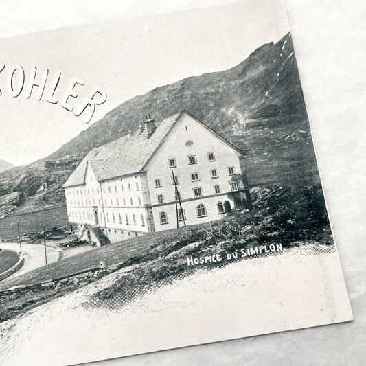
1900s - Vintage Chocolat Kohler Advertising Postcard - Simplon Hospice Swiss Alps - Historic European Chocolate Ad Ephemera
Regular price €6,00 EURRegular priceUnit price per -
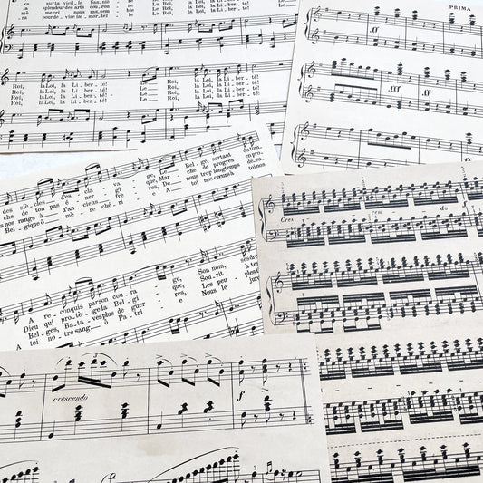
1930s - Vintage French Sheet Music Fragments from 1920s to 1940s - Antique Musical Ephemera for Art and Decor
Regular price €6,00 EURRegular priceUnit price per -
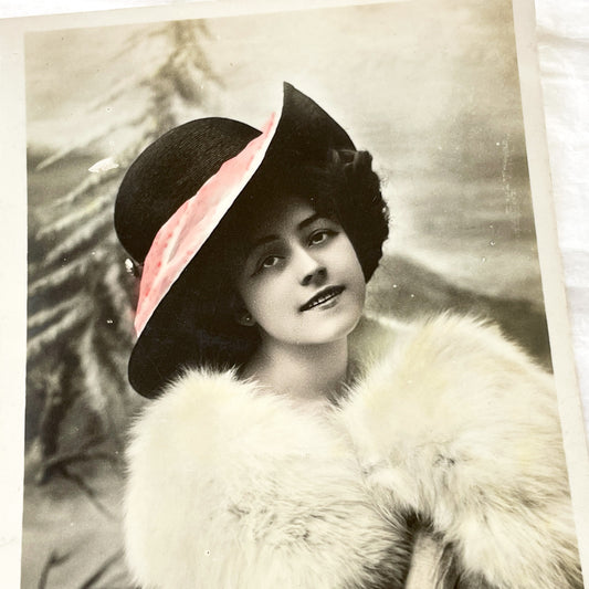
1910s - Elegant Edwardian Lady Postcard - Hand Colored Fashion Portrait - Vintage New Year Greeting Card Ephemera Collectible
Regular price €4,20 EURRegular priceUnit price per -
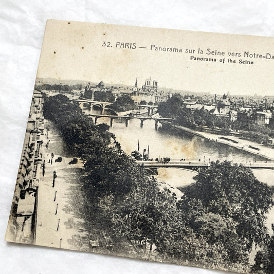
1910s - Vintage Paris Seine River Panorama Postcard - Notre-Dame Cathedral - Historical French City View - Early 20th Century Collectible
Regular price €4,20 EURRegular priceUnit price per -
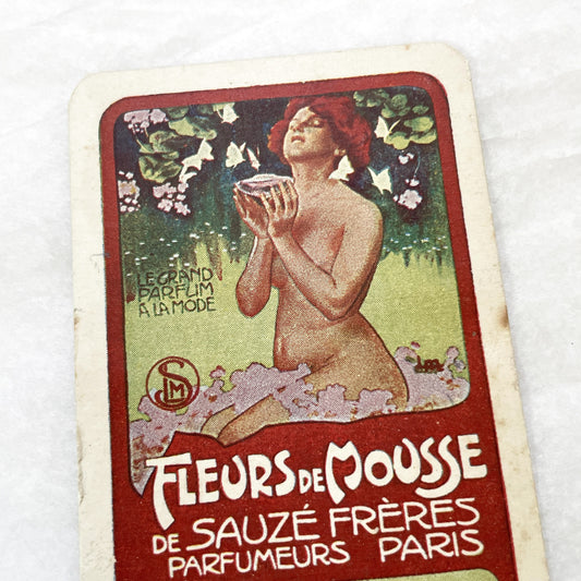
1900s - Vintage French Perfume Advertising Card - 'Fleurs de Mousse' by Sauzé Frères Paris - Art Nouveau - Maison Tambutté Coiffeur
Regular price €4,80 EURRegular priceUnit price per -
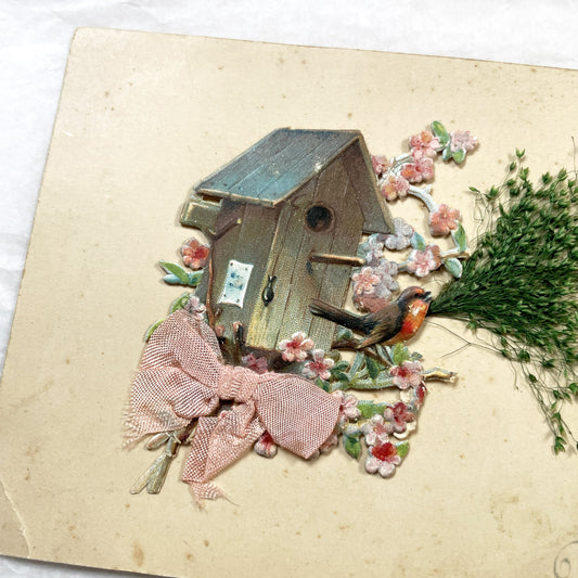
1900s - Vintage French New Year Postcard - Embossed Birdhouse with Robin - Applied Doves, Ribbon, and Dried Flora - Charming Ephemera
Regular price €8,40 EURRegular priceUnit price per -
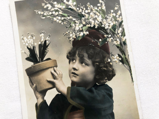
1900s - Charming Antique French Lily Of The Valley Postcard - Young Child Portrait - Muguet Spring Blossom Greeting Card
Regular price €4,20 EURRegular priceUnit price per -
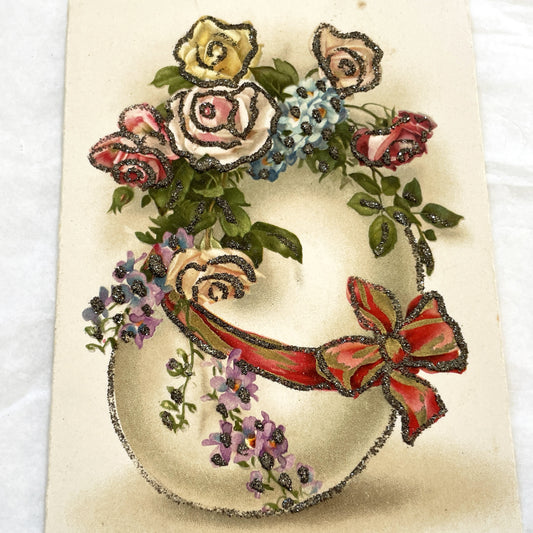
1950s - Vintage French Easter Postcard - Delicate Floral Wreath Design - Sparkling Glitter Embellishment - Joyeuses Paques Greeting
Regular price €4,20 EURRegular priceUnit price per -
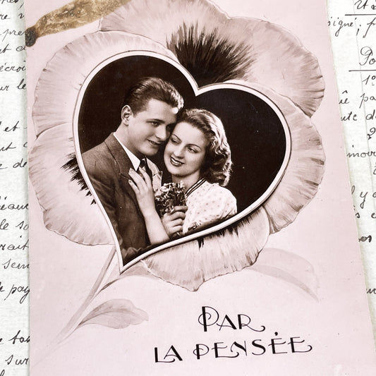
1930s - Vintage French Postcard - Romantic Pansy Flower Heart Frame - Young Couple - Black White Photo - Love - Sentimental Ephemera
Regular price €4,20 EURRegular priceUnit price per -
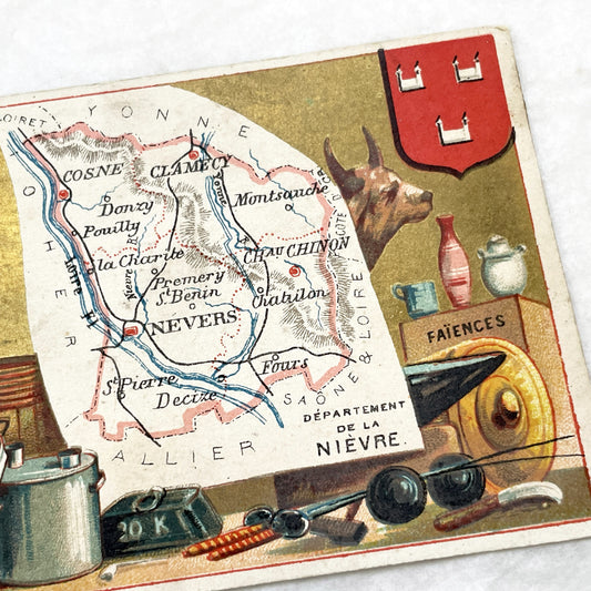
Late 19th - French Advertising Trade Card - Nièvre Map - Fil Géographique Thread - Regional Products - Nevers - Pouilly - Collectible Art
Regular price €4,80 EURRegular priceUnit price per -
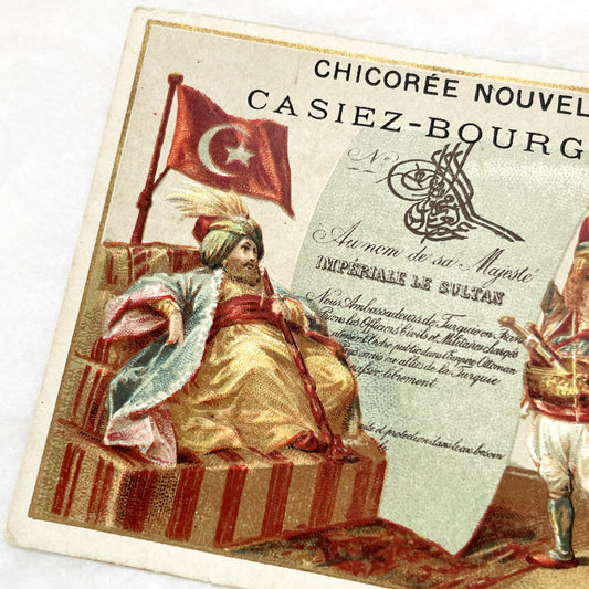
Late 19th - Chicory Advertising Card - Casiez-Bourgeois Ottoman Sultan Themed French Trade Card - Vintage Ephemera Collectible
Regular price €5,40 EURRegular priceUnit price per -
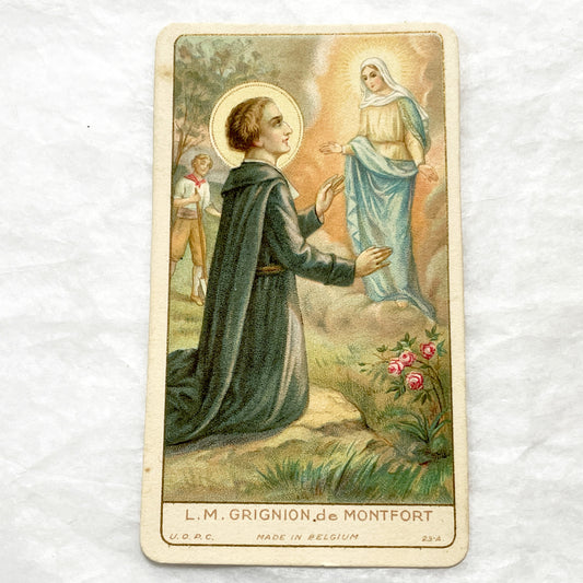
1910s - 2 Antique Catholic Holy Cards - Saint Louis de Montfort Devotional Art - Religious Ephemera for Collectors and Crafters
Regular price €4,80 EURRegular priceUnit price per -
Mid 19th - Antique Colored Print - Zoological Engraving - African Gazelle Antelope - Natural History Illustration - Detailed Animal Art
Regular price €10,80 EURRegular priceUnit price per -
1880s - Exquisite Journal des Demoiselles Fashion Plate - Antique French Engraving - Victorian Women and Child Period Costume Illustration
Regular price €15,60 EURRegular priceUnit price per -
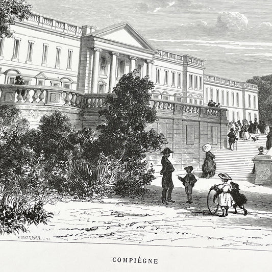
Late 19th - Compiègne Château Engraving - French Palace Grand Staircase - Park Life - Historic Architectural Print - Art by Girardet
Regular price €7,20 EURRegular priceUnit price per -
1900s - Vintage French Menu - Elegant Handwritten Meal Card - Monsieur Bernard Jeuvrin's Dinner - Historic Dining Experience
Regular price €3,60 EURRegular priceUnit price per -
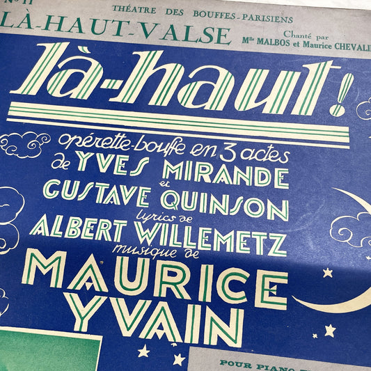
1920s - French Operetta Sheet Music - Là-Haut! - Maurice Yvain Score - Théâtre des Bouffes-Parisiens - Vintage Musical Score
Regular price €6,00 EURRegular priceUnit price per -
Late 19th - Illustrated Motto Card - Farm Scene Advertising Blank Space for Printer or Merchant Customization - Vintage Collectible Ephemera
Regular price €3,00 EURRegular priceUnit price per -
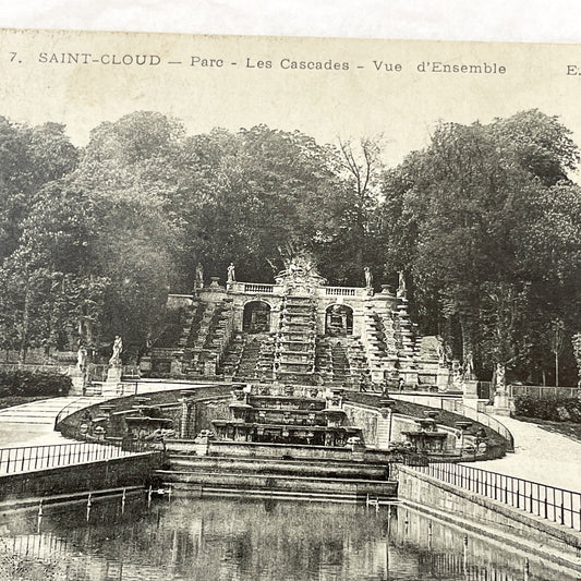
1900s - Vintage Saint-Cloud Parc Les Cascades Postcard - Historic French Fountain Landscape View - Original Black & White Paris Area
Regular price €4,80 EURRegular priceUnit price per -
1960s - English correspondence from France – Set of 15+ sheets (30 pages) – Handwritten romantic letters – Vintage letters on paper
Regular price €6,00 EURRegular priceUnit price per -
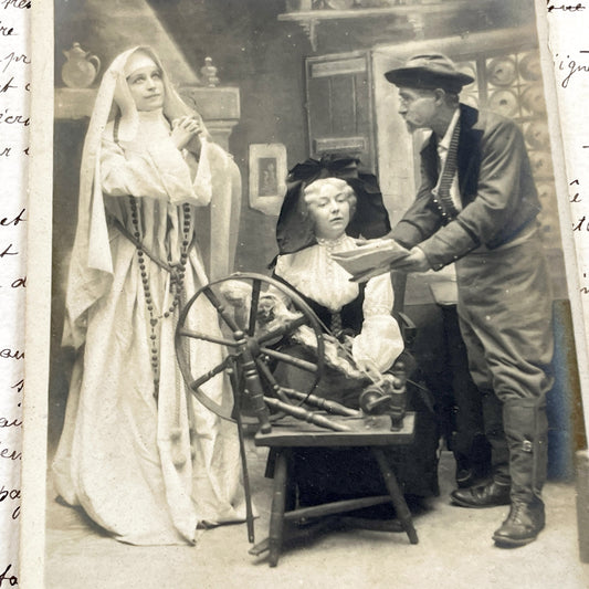
1900s - Antique French Postcard - Nun And Woman At Spinning Wheel - Religious Allegory - Vintage Sepia Photograph - Dramatic Scene
Regular price €3,60 EURRegular priceUnit price per -
Mid 19th century - Original Hand-Colored Engraving - Blue Antelope Klipspringer Gnu Condama - French Zoological Print - African Animals Art
Regular price €10,80 EURRegular priceUnit price per -
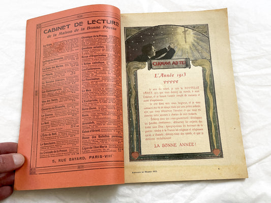
1910s - Vintage 1913 French Catholic Almanac - Illustrated Religious Annual - La Bonne Presse Ephemera - Rare Paris Book
Regular price €18,00 EURRegular priceUnit price per -
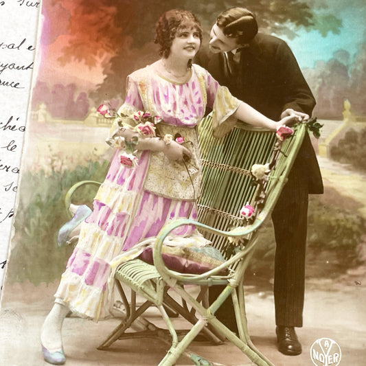
1910s - Vintage French Art Postcard - Romantic Couple Photo - Hand-Colored Ephemera - Belle Epoque Collectible - Noyer Publisher
Regular price €4,80 EURRegular priceUnit price per -
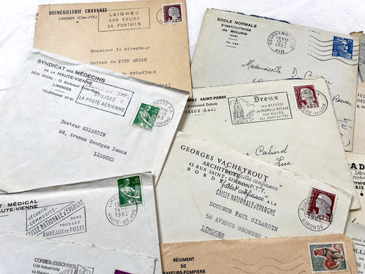
1950s - 20 French envelopes from 1950s and 1960s - Without letters inside - Ephemera for Junk Journals, Collage & Paper Crafts
Regular price €10,80 EURRegular priceUnit price per -
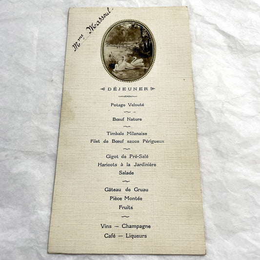
1910s - French Dinner and Lunch Menu - Elegant Vintage Event Card with Swans - Historical Culinary Document - WWI Era Fine Dining
Regular price €6,00 EURRegular priceUnit price per -
Mid 19th - Original Antique Monkey Print - Travies Zoology Engraving - Howler Spider Monkeys - Natural History Art Wall Decor
Regular price €10,80 EURRegular priceUnit price per -
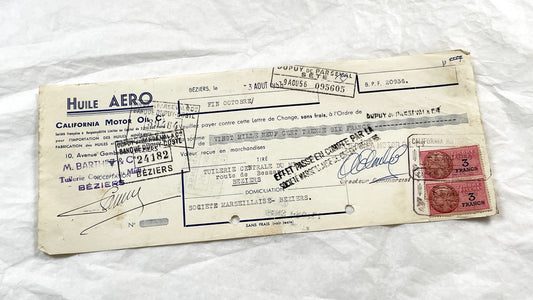
1950s - Lot of 6 Vintage French Bills of Exchange – Handwritten Commercial Documents with Stamps
Regular price €7,20 EURRegular priceUnit price per -
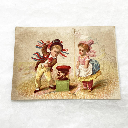
Late 19th - 2 Vintage Children's Chromo Cards - Playful Orientalist & Circus Themed Illustrations - Antique Collectible Art Prints
Regular price €6,00 EURRegular priceUnit price per -
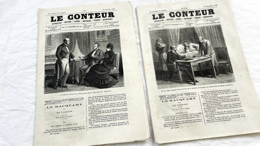
Late 19th - French Literary Newspaper Duo - Le Conteur Publications from 1880-1881 - Vintage French Periodical Set with Engravings
Regular price €8,40 EURRegular priceUnit price per -
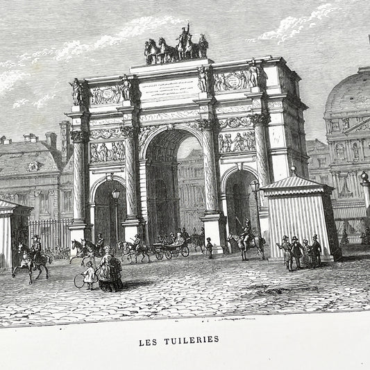
Late 19th - Parisian Arc de Triomphe du Carrousel Engraving - Historic Tuileries Garden Scene - Vintage French Architecture Art Print
Regular price €9,60 EURRegular priceUnit price per -
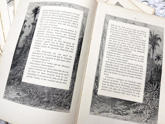
1880s – Set of 16 engraved sheets with ornate borders and French text - Antique illustrated book pages
Regular price €8,40 EURRegular priceUnit price per -
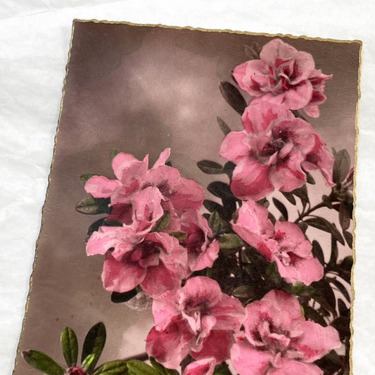
1910s - Vintage Azalea Rhododendron Floral Art Print Card - Gilded Edges Antique Ephemera - Pink Flower Bouquet - Collectible Botanical
Regular price €3,00 EURRegular priceUnit price per -
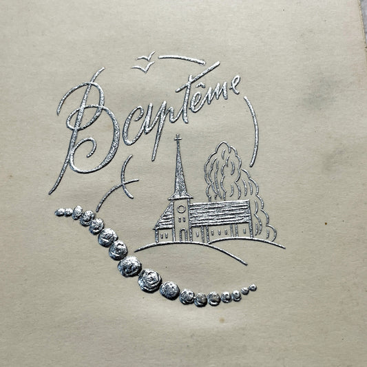
1950s - Vintage Baptism Menu Card - Jean-Claude Ceremony - 1951 - Elegant Silver Embossed Design - Classic Cuisine Celebration Memento
Regular price €4,20 EURRegular priceUnit price per -
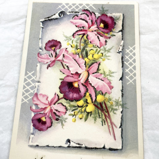
1950s - French Happy Birthday Postcard with Glittery Pink Orchids - Antique Floral Greeting Card - Unique Collectible Ephemera
Regular price €3,60 EURRegular priceUnit price per -
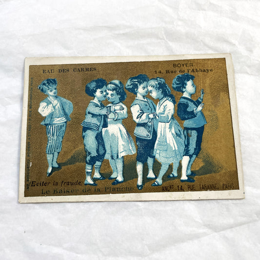
1900s - Children Playing Folk Games - Vintage French Chromo Cards - Antique Advertising Ephemera - Paris Collectible Artwork
Regular price €5,40 EURRegular priceUnit price per