There are no more items in your cart

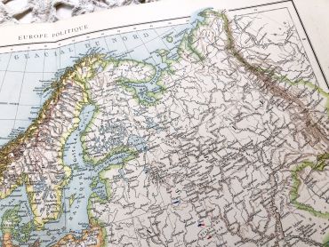
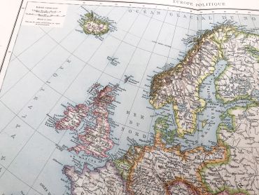
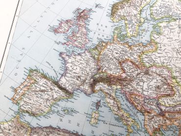
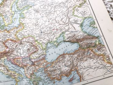
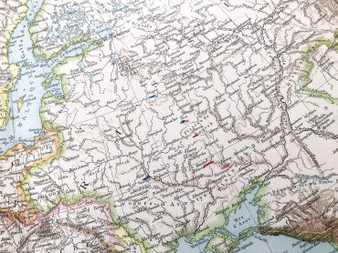
Huge vintage map of Europe from a French atlas of the 1910s. This map on two pages measures 54 x 41 cm and forms the front of the document.
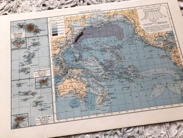
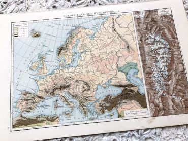
On the back you will find a smaller map of the Pacific Ocean (41 x 27 cm) and a hypsometric physical map of Europe (41 x 27 cm) in the 1910s.
At that time Germany was very different from today and Poland was not an independent state.
These maps show the world as it was in 1910s...
Except for digital products, all items are not reproductions, so there may be some wear and tear depending on age what makes it so charming.
Feel free to contact me if you have any questions.
The dimensions and weight of the items offered on this site are expressed in centimeters (cm) and in kilogram (kg).
Here is some information to help you convert them into your own measurement system:
- 10 cm is about 4 inches,
- 1 kg is about 2.2 pounds.

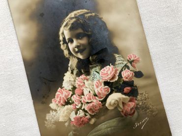
Vintage Belgian "Bonne fête" postcard with young girl with a bouquet of flowers from 1910.
This postcard bears the mention "De tout coeur" which can be translated into "wholeheartedly".
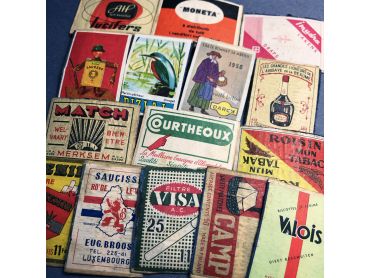
15 vintage matchbox labels - Advertising labels from 1930s to 1950s.
Labels are always glued to wood.
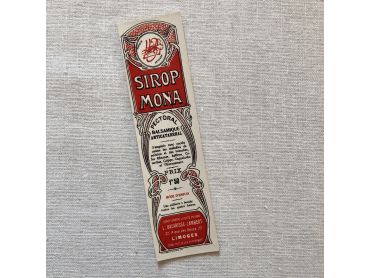
Beautiful care or beauty product labels - Early 20th century.
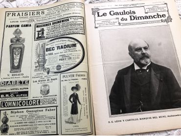
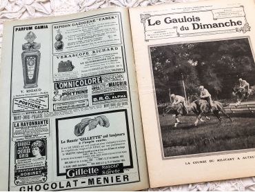
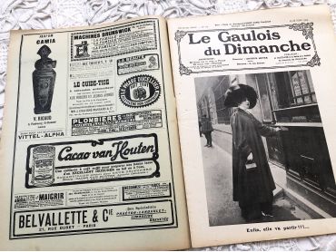
Large 24-page French weekly newspaper "Le Gaulois du Dimanche" of October 1909 with beautiful Art Nouveau cover, many articles about history, fashion, arts, literature, music, kitchen, and many engravings and photos.
Le Gaulois is a daily French literary and political newspaper founded on July 5, 1868. It became the property of press boss Arthur Meyer and was published until 1929 before being merged with the Figaro. Due to it large size, this magazine will be sent folded in half.
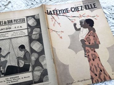
Vintage French fashion magazine "La femme chez elle" with illustrations, articles and advertising - April 1931 - 34 pages
"La femme chez elle" is a French bi-weekly women’s magazine, founded in 1899, then disappeared in 1938. Everyday life is relayed through embroidery, cooking, education, good manners or even furniture advice.
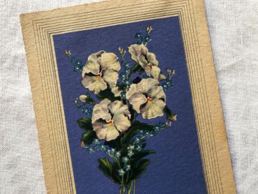
French postcard with a flower and the inscription "Bonne fête" from 1940s. Postcard sent in 1947.
In Europe and probably in other countries, it is tradition to wish a "bonne fête" to relatives and friends according to their first name and the calendar of saints. It is a tradition dating from the 16th century that lasted until the beginning of the 20th century and is gradually being lost.
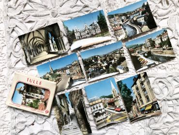
Set of 10 photos of the city of Tulle (France) in the 1950s.
These photos are typical of the 1950s and 1960s, during which tourism progressed a lot but not all tourists were equipped with a camera. These photos were sold on the tourist sites allowing everyone to keep a souvenir of the visit.
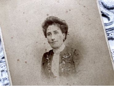
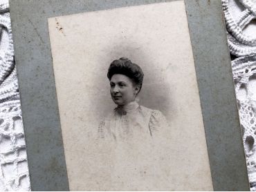
Old French photograph of a woman of the middle class made by the photographer Léon Langlois in Paris. This photograph can be dated from 1882 to 1890 since Léon Langlois began his activity in 1882 at 7 Boulevard Sébastopol and moved his photography salon in 1890 at 76 Boulevard Voltaire.
Large 24-page French weekly newspaper "Le Gaulois du Dimanche" of June 1909 with beautiful Art Nouveau cover, many articles about history, fashion, arts, literature, music, kitchen, and many engravings and photos.
Le Gaulois is a daily French literary and political newspaper founded on July 5, 1868. It became the property of press boss Arthur Meyer and was published until 1929 before being merged with the Figaro. Due to it large size, this magazine will be sent folded in half.
Old French photograph of a middle class woman in the 1900s made by the photographer Emile Boulin in Orléans.
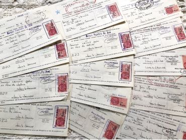
10 French bills of exchange from a hardware store in eastern France from 1960s.
These bills of exchange are financial instruments for loans between companies. Before the massive arrival of computers, these exchanges were carried out by hand as shown by these documents. The last photos shows the back of the bills of exchange.
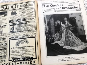
Large 24-page French weekly newspaper "Le Gaulois du Dimanche" of March 1909 with beautiful Art Nouveau cover, many articles about history, fashion, arts, literature, music, kitchen, and many engravings and photos.
Le Gaulois is a daily French literary and political newspaper founded on July 5, 1868. It became the property of press boss Arthur Meyer and was published until 1929 before being merged with the Figaro. Due to it large size, this magazine will be sent folded in half.
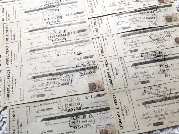
Set of 10 French bills of exchange a bookshop of the city of Dijon from 1930s with tax stamps and rubber-stamps.
Dimensions: 25 x 10 cm for nine bills et 27 x 10 for the largest.
The last photo shows the back of the bills of exchange.
These bills of exchange are financial instruments for loans between companies. Before the massive arrival of computers, these exchanges were carried out by hand as shown by these documents.
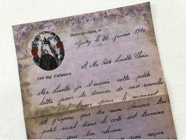
Beautiful French letterhead from a soldier send in 1940 to his wife. Beautiful header of 134th Infantry Regiment of French army with the effigy of a Gaul.
The letter suffered the outrages of time and humidity which also makes it visually beautiful to me
Large 24-page French weekly newspaper "Le Gaulois du Dimanche" of May 1909 with beautiful Art Nouveau cover, many articles about history, fashion, arts, literature, music, kitchen, and many engravings and photos.
Le Gaulois is a daily French literary and political newspaper founded on July 5, 1868. It became the property of press boss Arthur Meyer and was published until 1929 before being merged with the Figaro. Due to it large size, this magazine will be sent folded in half.
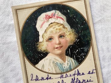
Belgian postcard with beautiful illustration representing a young girl. This postcard is written on the front.
This postcard dates from 1910s.
Huge vintage map of Europe from a French atlas of the 1910s. This map on two pages measures 54 x 41 cm and forms the front of the document.
On the back you will find a smaller map of the Pacific Ocean (41 x 27 cm) and a hypsometric physical map of Europe (41 x 27 cm) in the 1910s.
At that time Germany was very different from today and Poland was not an independent state.
These maps show the world as it was in 1910s...