There are no more items in your cart

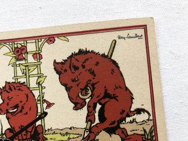
A funny animal illustration by French painter and illustrator Ray-Lambert dating from the 1930s.
By buying this product you can collect up to
3
loyalty points
.
Your cart will contain total
3
points
that can be converted into a voucher of
€0.15
.
Except for digital products, all items are not reproductions, so there may be some wear and tear depending on age what makes it so charming.
Feel free to contact me if you have any questions.
The dimensions and weight of the items offered on this site are expressed in centimeters (cm) and in kilogram (kg).
Here is some information to help you convert them into your own measurement system:
- 10 cm is about 4 inches,
- 1 kg is about 2.2 pounds.

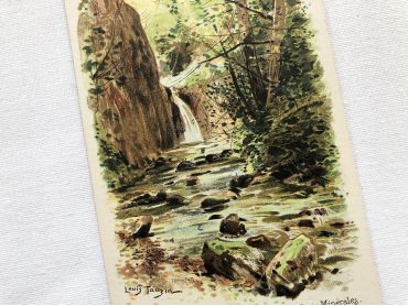
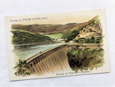
French vintage postcard of Saint-Alban-les-Eaux by the painter Louis Tauzin from 1900s.
Louis Tauzin, born July 21, 1842 in Barsac and died August 30, 1915 in Royan in 1915, is a French landscape painter and affichiste-chromolithographer. Between 1900 and 1910, Louis Tauzin painted a series of watercolours of water towns (Saint-Alban-les-Eaux, Évian, Vichy) which were used as models for postcards.
More information at https://fr.wikipedia.org/wiki/Louis_Tauzin
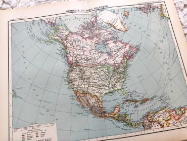
Large vintage map of North America from a French atlas of the 1910s. This map on two pages measures 46 x 37 cm and forms the front of the document.
These maps show the world as it was in 1910s...
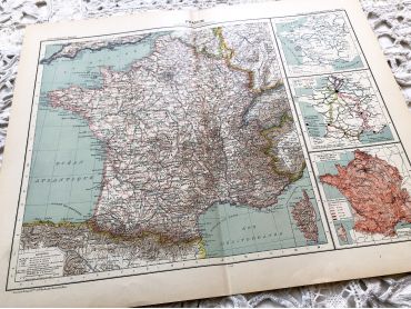
Large vintage map of France physical and administrative from a French atlas of the 1910s. This map on two pages measures 46 x 37 cm and forms the front of the document.
These maps show the world as it was in 1910s...
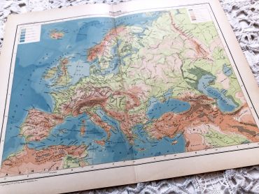
Large vintage map of Europe from a French atlas of the 1910s. This map on two pages measures 46 x 37 cm and forms the front of the document.
These maps show the world as it was in 1910s...
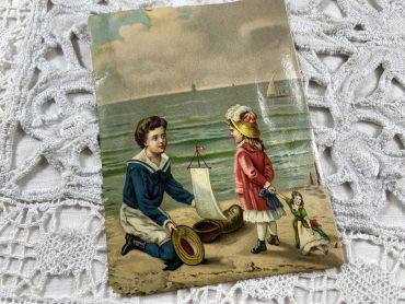
Large French chromo representing children at the beach from the end of 19th century.
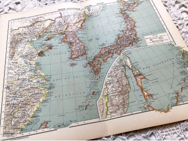
Large vintage map of East China, Korea and Japan from a French atlas of the 1910s. This map on two pages measures 46 x 37 cm and forms the front of the document.
These maps show the world as it was in 1910s...
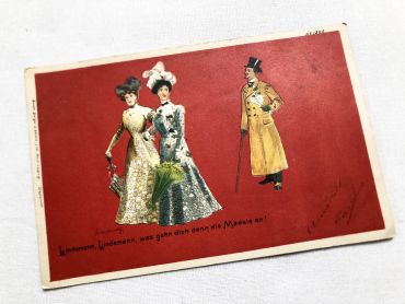
Vintage German postcard with two ladies and a gentleman from 1900s.
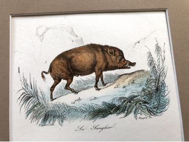
French engraving representing a boar and pigs by the drawer Victor Adam dating from the middle of the 19th century.
Jean-Victor Vincent Adam, born in Paris on January 28, 1801 and died in Viroflay on December 30, 1866, is a French painter and lithographer. He has illustrated numerous works and his drawings have been interpreted in engraving by Antoine François Gelée, Émile Giroux and Jean-François Pourvoyeur.
This engraving is probably the result of a reissue of the encyclopedia on wildlife of Buffon.
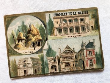
Vintage French chromolithograph of the Chocolat de la Marine brand from 1910s
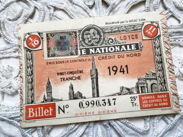
Huge French lottery ticket "Loterie Nationale" from 1941.
These lottery tickets were sold on the street or in small shops to help veterans.
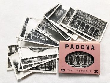
Set of 20 photos of the city of Padua (Italy) in the 1950s.
These photos are typical of the 1950s and 1960s, during which tourism progressed a lot but not all tourists were equipped with a camera. These photos were sold on the tourist sites allowing everyone to keep a souvenir of the visit.
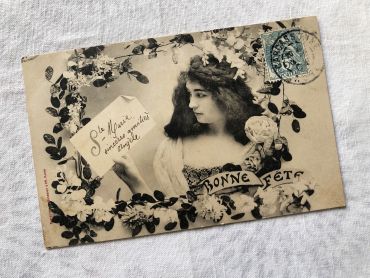
French postcard representing a young woman surrounded by flowers with the legend "Bonne fête". This postcard dates from 1900s. it has been sent, but the back is unwritten.
French vintage postcard of Saint-Alban-les-Eaux by the painter Louis Tauzin from 1900s.
Louis Tauzin, born July 21, 1842 in Barsac and died August 30, 1915 in Royan in 1915, is a French landscape painter and affichiste-chromolithographer. Between 1900 and 1910, Louis Tauzin painted a series of watercolours of water towns (Saint-Alban-les-Eaux, Évian, Vichy) which were used as models for postcards.
More information at https://fr.wikipedia.org/wiki/Louis_Tauzin
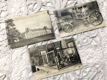
3 French postcards of Château de Malmaison from the 1930s.
"The Château de Malmaison is a French château situated near the left bank of the Seine, about 15 kilometres (9.3 mi) west of the centre of Paris, in the municipality of Rueil-Malmaison. Formerly the residence of Empress Joséphine de Beauharnais, along with the Tuileries it was the headquarters of the French government from 1800 to 1802, and Napoleon's last residence in France at the end of the Hundred Days in 1815. " (from Wikipedia)
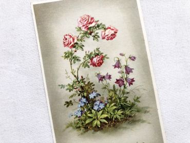
Vintage French postcard with a bouquet of roses from 1950s.
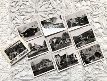
Set of 10 photos of the Stetten camp near Sigmaringen (Germany) in the 1950s.
These photos are typical of the 1950s and 1960s, during which tourism progressed a lot but not all tourists were equipped with a camera. These photos were sold on the tourist sites allowing everyone to keep a souvenir of the visit.
A funny animal illustration by French painter and illustrator Ray-Lambert dating from the 1930s.