There are no more items in your cart
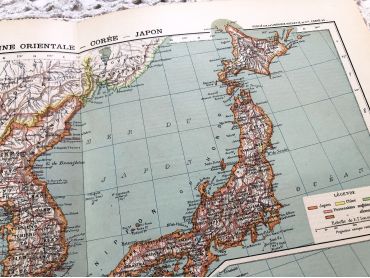

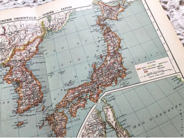
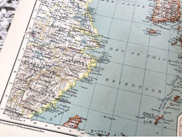
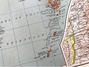
Large vintage map of East China, Korea and Japan from a French atlas of the 1910s. This map on two pages measures 46 x 37 cm and forms the front of the document.
These maps show the world as it was in 1910s...
By buying this product you can collect up to
10
loyalty points
.
Your cart will contain total
10
points
that can be converted into a voucher of
€0.50
.
Except for digital products, all items are not reproductions, so there may be some wear and tear depending on age what makes it so charming.
Feel free to contact me if you have any questions.
The dimensions and weight of the items offered on this site are expressed in centimeters (cm) and in kilogram (kg).
Here is some information to help you convert them into your own measurement system:
- 10 cm is about 4 inches,
- 1 kg is about 2.2 pounds.

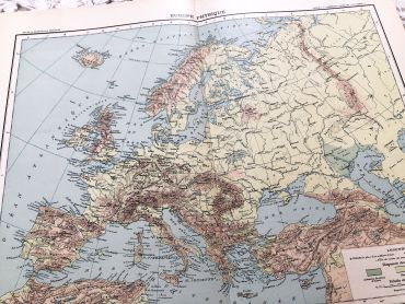
Large vintage map of Europe from a French atlas of the 1910s. This map on two pages measures 46 x 37 cm and forms the front of the document.
These maps show the world as it was in 1910s...
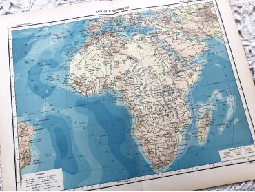
Large vintage map of Africa from a French atlas of the 1910s. This map on two pages measures 46 x 37 cm and forms the front of the document.
These maps show the world as it was in 1910s...
French engraving representing two types of monkey (the marmoset and the tamarind) dating from the middle of the 19th century.
This engraving is probably the result of a reissue of the encyclopedia on wildlife of Buffon.
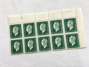
Block of 10 old French stamps "Marianne de Dulac" or "Marianne de Londres" - 10 stamps from 1940s
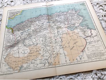
Large vintage map of Algeria and Tunisia from a French atlas of the 1910s. This map on two pages measures 46 x 37 cm and forms the front of the document.
These maps show the world as it was in 1910s...
Old French photograph of a mother and daughter in the 1920s made by the photographer Emile Mauvillier in Besançon.
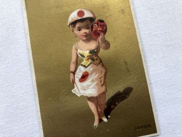
Vintage French chromolithograph with a young lady representing Japan with golden background from 1890s
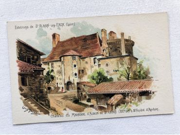
French vintage postcard of Saint-Alban-les-Eaux by the painter Louis Tauzin from 1900s.
Louis Tauzin, born July 21, 1842 in Barsac and died August 30, 1915 in Royan in 1915, is a French landscape painter and affichiste-chromolithographer. Between 1900 and 1910, Louis Tauzin painted a series of watercolours of spa towns (Saint-Alban-les-Eaux, Évian, Vichy) which were used as models for postcards.
More information at https://fr.wikipedia.org/wiki/Louis_Tauzin
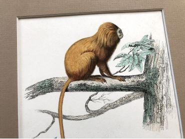
French engraving representing two types of monkey (the marikina and the mico) by the drawer Christophe Annedouche dating from the middle of the 19th century.
Christophe Annedouche (28 June 1803 – 10 June 1866) was a French engraver from Paris. He is known for his natural history illustrations in works such as Georges Cuvier's Le Règne Animal. This engraving is probably the result of a reissue of the encyclopedia on wildlife of Buffon.
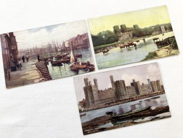
Set of 3 beautiful English postcards of landscapes from 1900s.
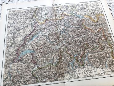
Large vintage map of Switzerland from a French atlas of the 1910s. This map on two pages measures 46 x 37 cm and forms the front of the document.
These maps show the world as it was in 1910s...
Belgian postcard of a little girl holding a little boy by the side of a canal from 1910s
Large vintage map of the United States of America from a French atlas of the 1910s. This map on two pages measures 46 x 37 cm and forms the front of the document.
These maps show the world as it was in 1910s...
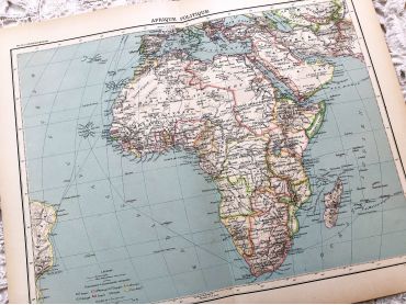
Large vintage map of the political Africa from a French atlas of the 1910s. This map on two pages measures 46 x 37 cm and forms the front of the document.
These maps show the world as it was in 1910s...
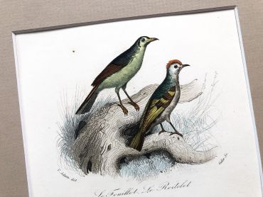
French engraving representing five birds from the middle of the 19th century.
This engraving is probably the result of a reissue of the encyclopedia on wildlife of Buffon.
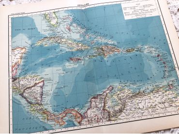
Large vintage map of the West Indies from a French atlas of the 1910s. This map on two pages measures 46 x 37 cm and forms the front of the document.
These maps show the world as it was in 1910s...
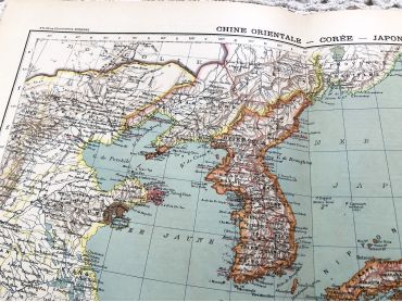
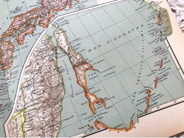
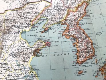
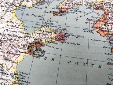
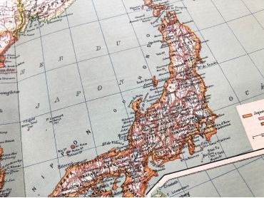
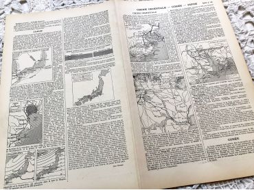
Large vintage map of East China, Korea and Japan from a French atlas of the 1910s. This map on two pages measures 46 x 37 cm and forms the front of the document.
These maps show the world as it was in 1910s...