There are no more items in your cart

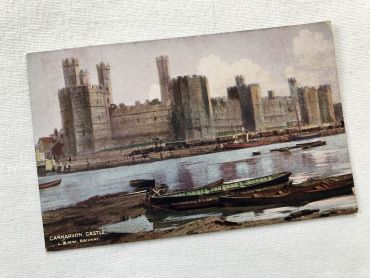
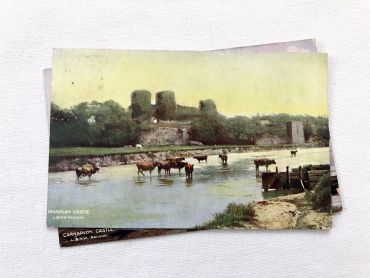
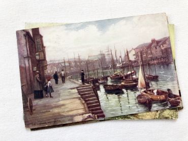
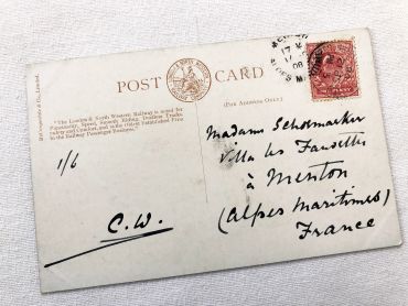
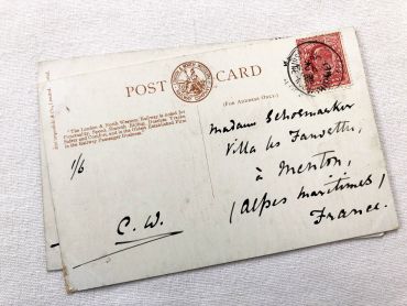
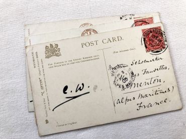
Set of 3 beautiful English postcards of landscapes from 1900s.
By buying this product you can collect up to
5
loyalty points
.
Your cart will contain total
5
points
that can be converted into a voucher of
€0.25
.
Except for digital products, all items are not reproductions, so there may be some wear and tear depending on age what makes it so charming.
Feel free to contact me if you have any questions.
The dimensions and weight of the items offered on this site are expressed in centimeters (cm) and in kilogram (kg).
Here is some information to help you convert them into your own measurement system:
- 10 cm is about 4 inches,
- 1 kg is about 2.2 pounds.

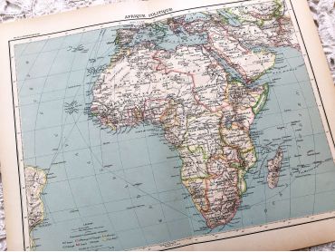
Large vintage map of the political Africa from a French atlas of the 1910s. This map on two pages measures 46 x 37 cm and forms the front of the document.
These maps show the world as it was in 1910s...
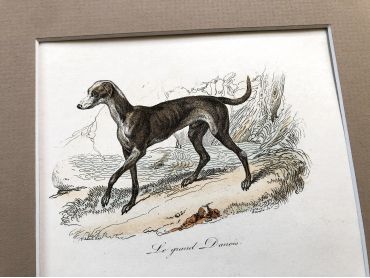
French engraving representing three types of dogs by the drawer Victor Adam dating from the middle of the 19th century.
Jean-Victor Vincent Adam, born in Paris on January 28, 1801 and died in Viroflay on December 30, 1866, is a French painter and lithographer. He has illustrated numerous works and his drawings have been interpreted in engraving by Antoine François Gelée, Émile Giroux and Jean-François Pourvoyeur.
This engraving is probably the result of a reissue of the encyclopedia on wildlife of Buffon.
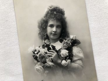
French postcard with a daughter carrying a bunch of roses from 1910s.
Postcard legend: "Vive Marie" / "Long live Mary"
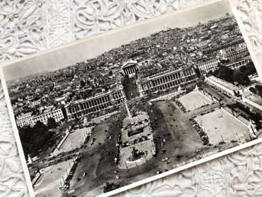
Huge aerial photography of Paris from 1950s
You will can see on the picture (in French): La Place de la concorde, l'hôtel Crillon, l'ancien Ministère de la Marine, le Sacré Coeur, l'Opéra Garnier, l'obélisque de la Place de la Concorde, le début du jardin des Tuileries et de nombreuses voitures de l'époque.
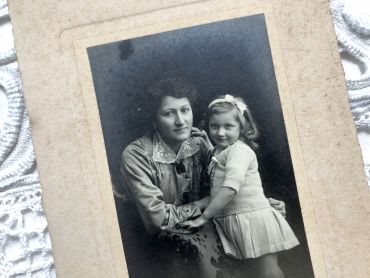
Old French photograph of a mother and daughter in the 1920s made by the photographer Emile Mauvillier in Besançon.
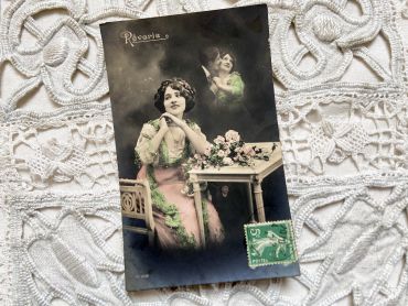
French postcard with a woman dreaming of her lover from 1910s
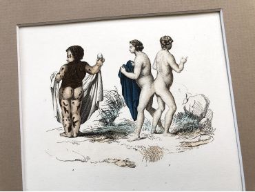
French engraving representing strange characters dating from the middle of the 19th century.
This engraving is probably the result of a reissue of the encyclopedia on wildlife of Buffon even if this engraving presents humans
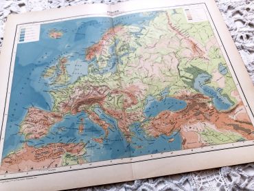
Large vintage map of Europe from a French atlas of the 1910s. This map on two pages measures 46 x 37 cm and forms the front of the document.
These maps show the world as it was in 1910s...
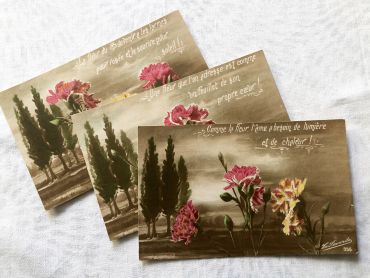
3 French postcards with sentimental thoughts on flowers from 1920s.
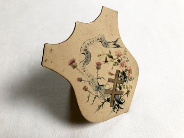
Religious crest hand painted with a Lorraine cross of the 1930s.
This object was most likely handmade by an individual. This small cardboard object can be placed thanks to a small retractable tab.
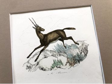
French engraving representing three types of gazelles by the drawer Victor Adam dating from the middle of the 19th century.
Jean-Victor Vincent Adam, born in Paris on January 28, 1801 and died in Viroflay on December 30, 1866, is a French painter and lithographer. He has illustrated numerous works and his drawings have been interpreted in engraving by Antoine François Gelée, Émile Giroux and Jean-François Pourvoyeur.
This engraving is probably the result of a reissue of the encyclopedia on wildlife of Buffon.
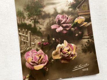
Vintage French postcard with a bouquet of flowers from 1920s.
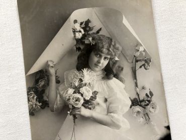
Vintage Belgian postcard with young girl with a bouquet of flowers from 1900s.
Postcard legend: "Vive Marie" / "Long live Mary"
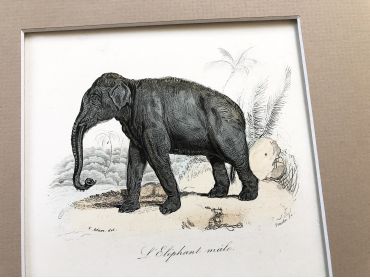
French engraving representing an African elephant and an Asian elephant by the drawer Victor Adam dating from the middle of the 19th century.
Jean-Victor Vincent Adam, born in Paris on January 28, 1801 and died in Viroflay on December 30, 1866, is a French painter and lithographer. He has illustrated numerous works and his drawings have been interpreted in engraving by Antoine François Gelée, Émile Giroux and Jean-François Pourvoyeur.
This engraving is probably the result of a reissue of the encyclopedia on wildlife of Buffon.
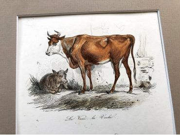
French engraving representing a calf, a cow, a sheep, a ram and a lamb by the drawer Victor Adam dating from the middle of the 19th century.
Jean-Victor Vincent Adam, born in Paris on January 28, 1801 and died in Viroflay on December 30, 1866, is a French painter and lithographer. He has illustrated numerous works and his drawings have been interpreted in engraving by Antoine François Gelée, Émile Giroux and Jean-François Pourvoyeur.
This engraving is probably the result of a reissue of the encyclopedia on wildlife of Buffon.
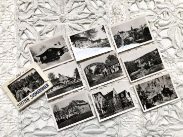
Set of 10 photos of the Stetten camp near Sigmaringen (Germany) in the 1950s.
These photos are typical of the 1950s and 1960s, during which tourism progressed a lot but not all tourists were equipped with a camera. These photos were sold on the tourist sites allowing everyone to keep a souvenir of the visit.
Set of 3 beautiful English postcards of landscapes from 1900s.