There are no more items in your cart

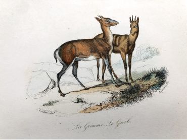
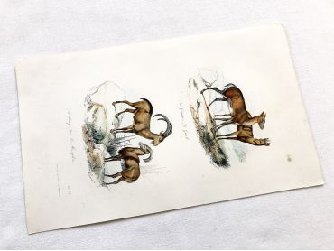
French engraving representing four types of ibex and sheep by the drawer Victor Adam dating from the middle of the 19th century.
Jean-Victor Vincent Adam, born in Paris on January 28, 1801 and died in Viroflay on December 30, 1866, is a French painter and lithographer. He has illustrated numerous works and his drawings have been interpreted in engraving by Antoine François Gelée, Émile Giroux and Jean-François Pourvoyeur.
This engraving is probably the result of a reissue of the encyclopedia on wildlife of Buffon.
By buying this product you can collect up to
12
loyalty points
.
Your cart will contain total
12
points
that can be converted into a voucher of
€0.60
.
Except for digital products, all items are not reproductions, so there may be some wear and tear depending on age what makes it so charming.
Feel free to contact me if you have any questions.
The dimensions and weight of the items offered on this site are expressed in centimeters (cm) and in kilogram (kg).
Here is some information to help you convert them into your own measurement system:
- 10 cm is about 4 inches,
- 1 kg is about 2.2 pounds.

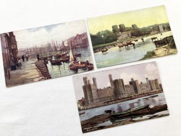
Set of 3 beautiful English postcards of landscapes from 1900s.
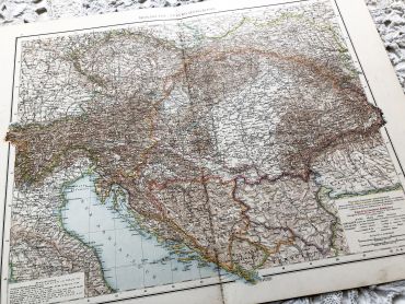
Huge vintage map of the Austro-Hungarian monarchy (Hungary, Czech Republic, Austria, etc.) from a French atlas of the 1910s. This map on two pages measures 54 x 41 cm and forms the front of the document.
On the back you will find a smaller map of French Alps (41 x 27 cm) and a map of the region of Hungary (41 x 27 cm) in the 1910s.
These maps show the world as it was in 1910s...
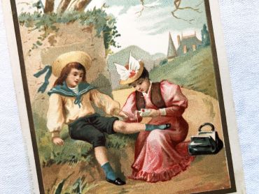
Vintage French trade card of the famous mint alcohol brand Ricqulès - Chromo about 1890s
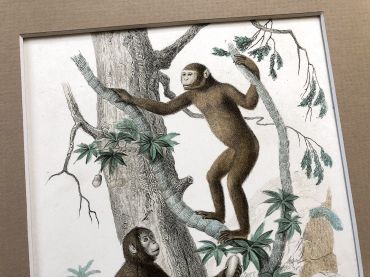
French engraving representing two types of monkey (the jocko and the pongo) by the drawer Edouard Travies dating from the middle of the 19th century.
Édouard Traviès de Villers, born in Doullens on March 24, 1809, and died in Paris 5th on November 18, 18761, is a well-known animal painter, illustrator and lithographer. This engraving is probably the result of a reissue of the encyclopedia on wildlife of Buffon.
The Jocko is a monkey described by the Earl of Buffon in the fourteenth volume of his Natural History published in 17661. It is presented, alongside the «Pongo», as an orangutan. His description actually corresponds to that of a chimpanzee reported to France in 1740 and died the following year in London.
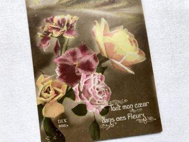
Vintage French postcard with a bouquet of lily of the valley from 1920s.
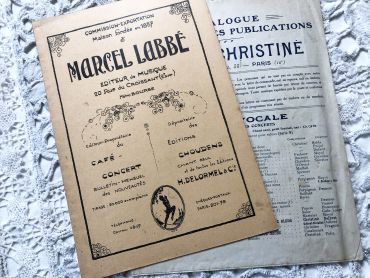
18 pages music catalogue of the Parisian music publisher Marcel Labbé from 1920s.
As a gift, another small music catalogue.
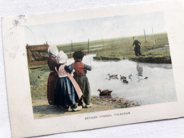
Belgian postcard of a group of children playing around a duck pond from 1910s
Vintage French advertising for Shell from the winter 1959 to 1960.
These models were given in Shell gas stations in France.
The different shapes come off and stick according to the instructions given on the board. This requires a little patience.
The first and the last photos show the result of another model made.
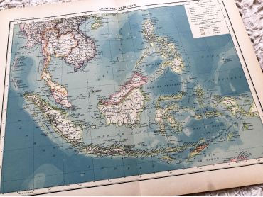
Large vintage map of the Asian archipelago (Indonesia, Singapore, etc.) from a French atlas of the 1910s. This map on two pages measures 46 x 37 cm and forms the front of the document.
These maps show the world as it was in 1910s...
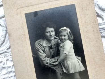
Old French photograph of a mother and daughter in the 1920s made by the photographer Emile Mauvillier in Besançon.
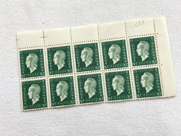
Block of 10 old French stamps "Marianne de Dulac" or "Marianne de Londres" - 10 stamps from 1940s
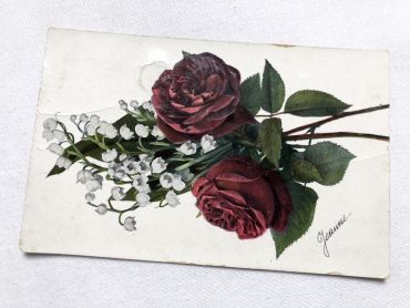
Vintage Belgian postcard with a bouquet of roses and lily of the valley from 1900s.
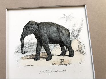
French engraving representing an African elephant and an Asian elephant by the drawer Victor Adam dating from the middle of the 19th century.
Jean-Victor Vincent Adam, born in Paris on January 28, 1801 and died in Viroflay on December 30, 1866, is a French painter and lithographer. He has illustrated numerous works and his drawings have been interpreted in engraving by Antoine François Gelée, Émile Giroux and Jean-François Pourvoyeur.
This engraving is probably the result of a reissue of the encyclopedia on wildlife of Buffon.
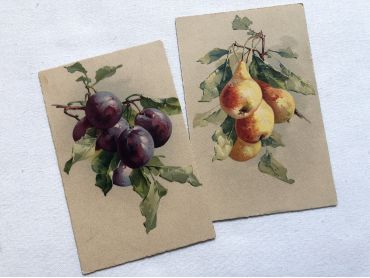
Two postcards representing pears and plums from 1900s.
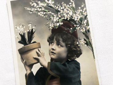
French postcard of a young child carrying a bunch of lily of the valley in a pot from 1900s. Postcard sent in 1907.
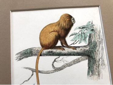
French engraving representing two types of monkey (the marikina and the mico) by the drawer Christophe Annedouche dating from the middle of the 19th century.
Christophe Annedouche (28 June 1803 – 10 June 1866) was a French engraver from Paris. He is known for his natural history illustrations in works such as Georges Cuvier's Le Règne Animal. This engraving is probably the result of a reissue of the encyclopedia on wildlife of Buffon.
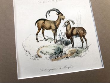
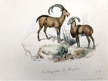
French engraving representing four types of ibex and sheep by the drawer Victor Adam dating from the middle of the 19th century.
Jean-Victor Vincent Adam, born in Paris on January 28, 1801 and died in Viroflay on December 30, 1866, is a French painter and lithographer. He has illustrated numerous works and his drawings have been interpreted in engraving by Antoine François Gelée, Émile Giroux and Jean-François Pourvoyeur.
This engraving is probably the result of a reissue of the encyclopedia on wildlife of Buffon.