4 French religious cards - First communion cards from...
4 French religious cards - First communion cards from 1930s and 1960s
Price
€4.00
There are no more items in your cart

There are 74 products.
4 French religious cards - First communion cards from 1930s and 1960s
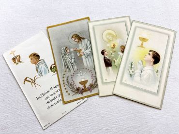
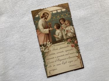
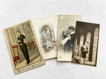
4 French religious cards - First communion cards from 1950s and 1960s
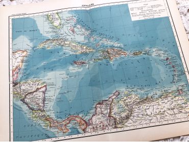
Large vintage map of the West Indies from a French atlas of the 1910s. This map on two pages measures 46 x 37 cm and forms the front of the document.
These maps show the world as it was in 1910s...
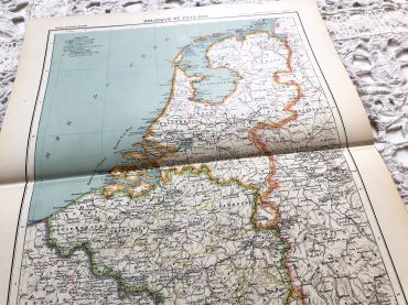
Large vintage map of The Netherlands from a French atlas of the 1910s. This map on two pages measures 46 x 37 cm and forms the front of the document.
These maps show the world as it was in 1910s...
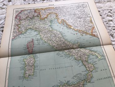
Large vintage map of Italy in 1910 from a French atlas from the 1910s. This map on two pages measures 46 x 37 cm and forms the front of the document.
These maps show the world as it was in 1910s...
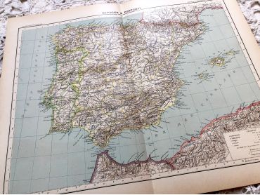
Large vintage map of Spain and Portugal in 1910 from a French atlas of the 1910s. This map on two pages measures 46 x 37 cm and forms the front of the document.
These maps show the world as it was in 1910s...
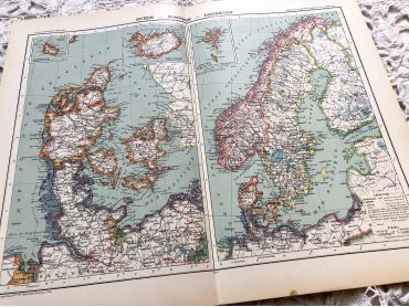
Large vintage map of Sweden, Norway and Denmark from a French atlas of the 1910s.
These maps show the world as it was in 1910s...
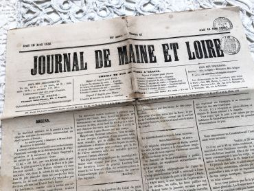
French newspaper "Le journal de Maine et Loire" of October 4, 1856 - 4 pages.
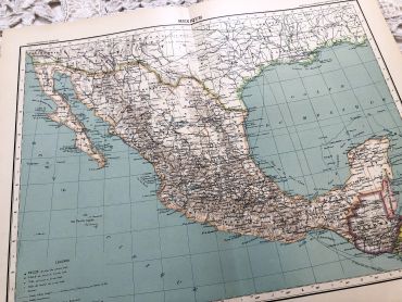
Large vintage map of Mexico from a French atlas of the 1910s. This map on two pages measures 46 x 37 cm and forms the front of the document.
These maps show the world as it was in 1910s...
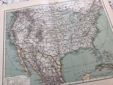
Large vintage map of the United States of America from a French atlas of the 1910s. This map on two pages measures 46 x 37 cm and forms the front of the document.
These maps show the world as it was in 1910s...
Large vintage map of United States of America from a French atlas of the 1910s. This map on two pages measures 46 x 37 cm and forms the front of the document.
These maps show the world as it was in 1910s...
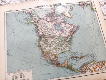
Large vintage map of North America from a French atlas of the 1910s. This map on two pages measures 46 x 37 cm and forms the front of the document.
These maps show the world as it was in 1910s...
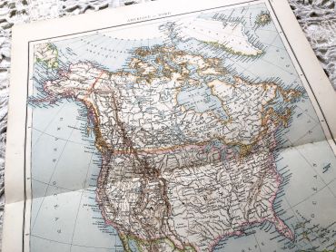
Huge vintage map of North America from a French atlas of the 1910s. This map on two pages measures 54 x 41 cm and forms the front of the document.
The back consists of a map of the northern part of South America (41 x 27 cm) and a map of major gold-producing regions in Africa in 1910s (41 x 27 cm) as shown in the last two photos.
These maps show the world as it was in 1910s...
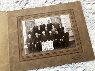
Large photo of 50 years of former classmates or military service comrades from 1930s.
Beautiful Italian religious card - Card nicely cut from 1910s
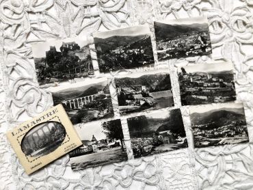
Set of 10 photos of the village of Lamastre (France) in the 1950s.
These photos are typical of the 1950s and 1960s, during which tourism progressed a lot but not all tourists were equipped with a camera. These photos were sold on the tourist sites allowing everyone to keep a souvenir of the visit.
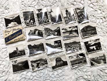
Set of 20 photos of the Auvergne region in France in the 1950s.
These photos are typical of the 1950s and 1960s, during which tourism progressed a lot but not all tourists were equipped with a camera. These photos were sold on the tourist sites allowing everyone to keep a souvenir of the visit.
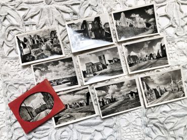
Set of 10 photos of the village of Ouradour-sur-Glane (France) in the 1950s.
The original village was destroyed on 10 June 1944, when 643 of its inhabitants, including women and children, were massacred by a company of troops belonging to the 2nd SS Panzer Division Das Reich, a Waffen-SS unit of the military forces of Nazi Germany. A new village was built after the war on a nearby site, but on the orders of the then French president, Charles de Gaulle, the original has been maintained as a permanent memorial. The Centre de la mémoire d'Oradour museum is located beside the historic site. (from Wikipedia)
These photos are typical of the 1950s and 1960s, during which tourism progressed a lot but not all tourists were equipped with a camera. These photos were sold on the tourist sites allowing everyone to keep a souvenir of the visit.
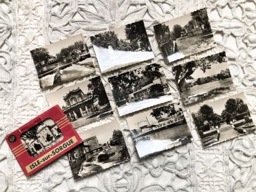
Set of 10 photos of the village of Isle-sur-Sorgue in the South of France in the 1950s.
These photos are typical of the 1950s and 1960s, during which tourism progressed a lot but not all tourists were equipped with a camera. These photos were sold on the tourist sites allowing everyone to keep a souvenir of the visit.
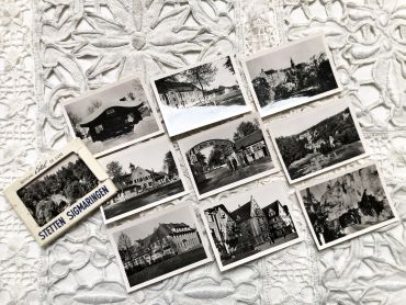
Set of 10 photos of the Stetten camp near Sigmaringen (Germany) in the 1950s.
These photos are typical of the 1950s and 1960s, during which tourism progressed a lot but not all tourists were equipped with a camera. These photos were sold on the tourist sites allowing everyone to keep a souvenir of the visit.
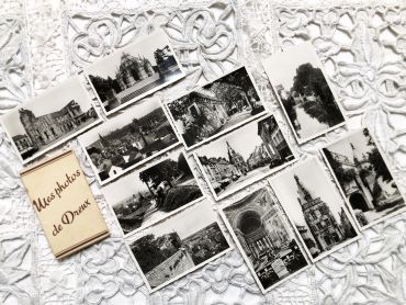
Set of 11 photos of the city of Dreux (France) in the 1950s.
These photos are typical of the 1950s and 1960s, during which tourism progressed a lot but not all tourists were equipped with a camera. These photos were sold on the tourist sites allowing everyone to keep a souvenir of the visit.
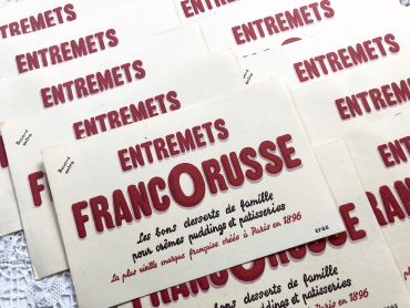
Advertising blotter of the French Francorusse entremets brand from 1950s
Blotting paper (or blotter) is a porous paper capable of absorbing a small amount of liquid. It was mainly used to dry the writing when it was written in ink with a pen: ink can be deposited irregularly and dried slowly could cause stains and maculatures, the use of blotting was often necessary.
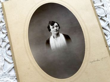
Old French photograph of a woman of the middle class from 1930s.
The date was inscribed in pencil "September 1931".
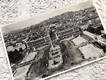
Huge aerial photography of Paris from 1950s
You will can see on the picture (in French): La Place de la concorde, l'hôtel Crillon, l'ancien Ministère de la Marine, le Sacré Coeur, l'Opéra Garnier, l'obélisque de la Place de la Concorde, le début du jardin des Tuileries et de nombreuses voitures de l'époque.