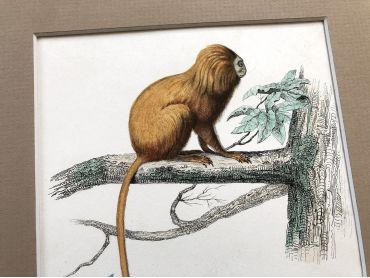
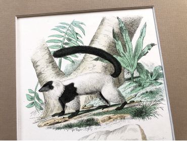
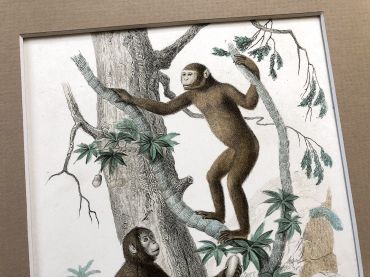
Documents

Discover many old French papers. All my documents are authentic and are at least 40 years old for the most recent and several centuries for the oldest. Depending on the time, you will find letters, envelopes, postcards, invoices, receipts, menus, labels, religious cards and many other types of documents.

Documents

There are 153 products.

Showing 113-140 of 153 item(s)

Active filters

  • Period: 19th century
  • Period: 1910s
  • Period: 1940s
  • Period: 1960s
  • Origin: Belgium
  • Origin: France
  • Origin: United Kingdom

Large vintage map of France physical and administrative...

Large vintage map of France physical and administrative from a French atlas of the 1910s. This map on two pages measures 46 x 37 cm and forms the front of the document.

These maps show the world as it was in 1910s...

Price €10.00

Large vintage map of north-west of France and Brest...

Large vintage map of north-west of France and Brest harbor from a French atlas of the 1910s. This map on two pages measures 46 x 37 cm and forms the front of the document.

These maps show the world as it was in 1910s...

Price €10.00

Large vintage map of the north-east of France and the...

Large vintage map of the north-east of France and the cities of Rouen, Lille and Le Havre from a French atlas of the 1910s. This map on two pages measures 46 x 37 cm and forms the front of the document.

These maps show the world as it was in 1910s...

Price €10.00

Large vintage map of South-East France and the cities of...

Large vintage map of South-East France and the cities of Paris and Bordeaux from a French atlas of the 1910s. This map on two pages measures 46 x 37 cm and forms the front of the document.

These maps show the world as it was in 1910s...

Price €10.00

Large vintage map of south-east of France, Corsica, and...

Large vintage map of south-east of France, Corsica, and the cities of Marseille, Lyon from a French atlas of the 1910s. This map on two pages measures 46 x 37 cm and forms the front of the document.

These maps show the world as it was in 1910s...

Price €10.00

Large vintage map of the French colonies in 1910 from a...

Large vintage map of the French colonies in 1910 (as Martinique, Guadeloupe, Guyane, etc.) from a French atlas of the 1910s. This map on two pages measures 46 x 37 cm and forms the front of the document.

These maps show the world as it was in 1910s...

Price €10.00

Large vintage map of French colonies in Africa and Asia...

Large vintage map of French colonies in Africa and Asia in 1910 from a French atlas of the 1910s. This map on two pages measures 46 x 37 cm and forms the front of the document.

These maps show the world as it was in 1910s...

Price €10.00

Large vintage map of North West Central Europe from a...

Large vintage map of North West Central Europe from a French atlas of the 1910s. This map on two pages measures 46 x 37 cm and forms the front of the document.

These maps show the world as it was in 1910s...

Price €10.00

Large vintage map of the Asian archipelago (Indonesia,...

Large vintage map of the Asian archipelago (Indonesia, Singapore, etc.) from a French atlas of the 1910s. This map on two pages measures 46 x 37 cm and forms the front of the document.

These maps show the world as it was in 1910s...

Price €10.00

Large vintage map of Indochina (Thailand, Vietnam,...

Large vintage map of Indochina (Thailand, Vietnam, Singapore, etc.) from a French atlas of the 1910s. This map on two pages measures 46 x 37 cm and forms the front of the document.

These maps show the world as it was in 1910s...

Price €10.00

Huge vintage map of the Austro-Hungarian monarchy...

Huge vintage map of the Austro-Hungarian monarchy (Hungary, Czech Republic, Austria, etc.) from a French atlas of the 1910s. This map on two pages measures 54 x 41 cm and forms the front of the document.

On the back you will find a smaller map of French Alps (41 x 27 cm) and a map of the region of Hungary (41 x 27 cm) in the 1910s.

These maps show the world as it was in 1910s...

Price €12.00

Huge vintage map of France from a French atlas of the 1910s

Huge vintage map of France from a French atlas of the 1910s. This map on two pages measures 54 x 41 cm and forms the front of the document.

On the back you will find a smaller map of Paris basin and the Mediterranean coasts of France (41 x 27 cm) and a map of northwest France (41 x 27 cm) in the 1910s.

These maps show the world as it was in 1910s...

Price €12.00