There are no more items in your cart

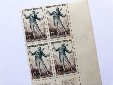
Block of 4 old French stamps representing Figaro de Beaumarchais from 1953. This stamp was created by draughtsman André Spitz and engraver Henry Cheffer. These stamps have not been used.
Except for digital products, all items are not reproductions, so there may be some wear and tear depending on age what makes it so charming.
Feel free to contact me if you have any questions.
The dimensions and weight of the items offered on this site are expressed in centimeters (cm) and in kilogram (kg).
Here is some information to help you convert them into your own measurement system:
- 10 cm is about 4 inches,
- 1 kg is about 2.2 pounds.

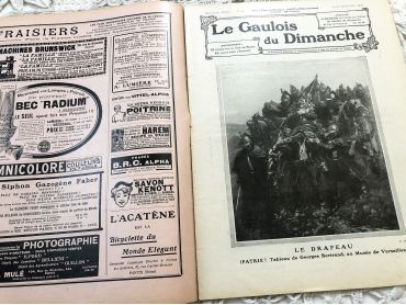
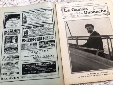
Large 24-page French weekly newspaper "Le Gaulois du Dimanche" of September 1909 with beautiful Art Nouveau cover, many articles about history, fashion, arts, literature, music, kitchen, and many engravings and photos.
Le Gaulois is a daily French literary and political newspaper founded on July 5, 1868. It became the property of press boss Arthur Meyer and was published until 1929 before being merged with the Figaro. Due to it large size, this magazine will be sent folded in half.
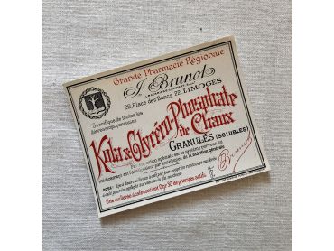
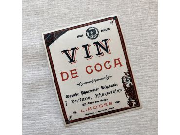
Beautiful care or beauty product labels - Early 20th century.
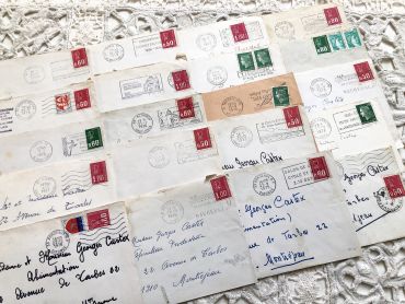
20 French envelopes from 1970s - Without letters inside.
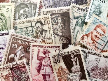
Set of 30 large vintage French stamps from 1940s to 1960s
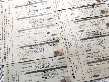
Set of 10 French bills of exchange a bookshop of the city of Dijon from 1930s with tax stamps and rubber-stamps.
Dimensions: 25 x 10 cm for nine bills et 27 x 10 for the largest.
The last photo shows the back of the bills of exchange.
These bills of exchange are financial instruments for loans between companies. Before the massive arrival of computers, these exchanges were carried out by hand as shown by these documents.
Large 24-page French weekly newspaper "Le Gaulois du Dimanche" of July 1909 with beautiful Art Nouveau cover, many articles about history, fashion, arts, literature, music, kitchen, and many engravings and photos.
Le Gaulois is a daily French literary and political newspaper founded on July 5, 1868. It became the property of press boss Arthur Meyer and was published until 1929 before being merged with the Figaro. Due to it large size, this magazine will be sent folded in half.
Beautiful care or beauty product labels - Early 20th century.
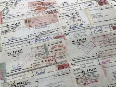
Set of 8 French bills of exchange of a shoe factory from 1950s with tax stamps and rubber-stamps.
Note that several bills of exchange have a hole in the lower left corner: these bills of exchange had to be stapled to the corresponding bills and had to be detached more or less cleanly once the customer had paid the expected amount.
The last photo shows the back of the bills of exchange.
These bills of exchange are financial instruments for loans between companies. Before the massive arrival of computers, these exchanges were carried out by hand as shown by these documents.
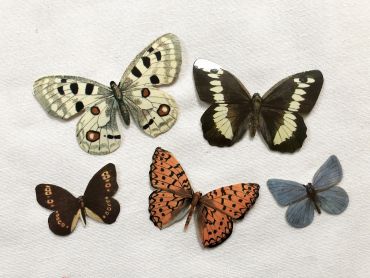
Set of 5 sticky advertising butterflies from a French biscuit company in the 1960s.
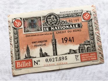
Huge French lottery tickets "Loterie Nationale" from 1941.
These lottery tickets were sold on the street or in small shops to help veterans.
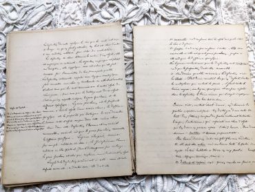
Set of 5 pages of philosophy course in French - beautiful writing on the front and back of each sheet.
These sheets were written by a high school student (E. Collin) in 1866.
The page in the last photo is not for sale, it indicates the date of these leaflets.
Each set is very similar to the photos presented and includes 5 leaflets written on the front and back.
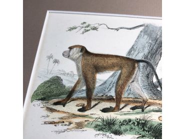
French engraving representing two types of monkeys by the drawer Edouard Travies dating from the middle of the 19th century.
Édouard Traviès de Villers, born in Doullens on March 24, 1809, and died in Paris 5th on November 18, 18761, is a well-known animal painter, illustrator and lithographer. This engraving is probably the result of a reissue of the encyclopedia on wildlife of Buffon.
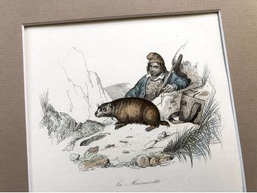
French engraving representing two large rodents and a hunter by the drawer Victor Adam dating from the middle of the 19th century.
Jean-Victor Vincent Adam, born in Paris on January 28, 1801 and died in Viroflay on December 30, 1866, is a French painter and lithographer. He has illustrated numerous works and his drawings have been interpreted in engraving by Antoine François Gelée, Émile Giroux and Jean-François Pourvoyeur.
This engraving is probably the result of a reissue of the encyclopedia on wildlife of Buffon.
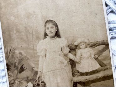
Old French photograph of a girl and her doll made by the photographer Numa Blanc (father) circa 1879 with a richly decorative back. This photo could be dated quite precisely thanks to the website ArtPlastoc at https://artplastoc.blogspot.com/2019/01/972-numa-blanc-1816-1897-numa-blanc.html.
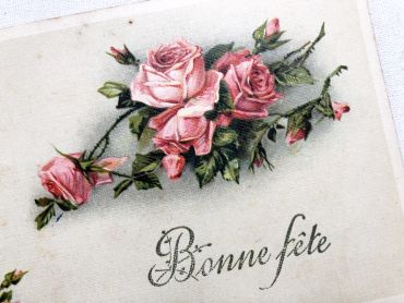
Vintage French postcard with some roses from 1940s.
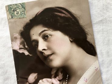
French postcard representing the cinema actress Else Berna.
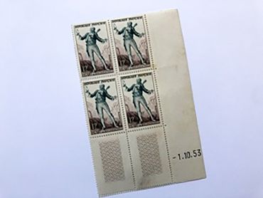
Block of 4 old French stamps representing Figaro de Beaumarchais from 1953. This stamp was created by draughtsman André Spitz and engraver Henry Cheffer. These stamps have not been used.