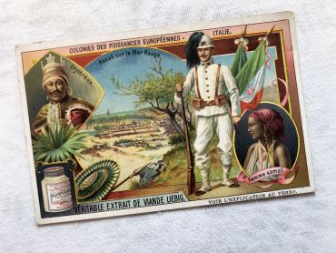
Vintage French chromolithograph of the Liebig brand from...
Vintage French chromolithograph of the Liebig brand from 1920s
Price
€3.00
There are no more items in your cart

There are 84 products.
Vintage French chromolithograph of the Liebig brand from 1920s
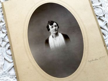
Old French photograph of a woman of the middle class from 1930s.
The date was inscribed in pencil "September 1931".
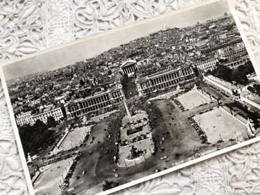
Huge aerial photography of Paris from 1950s
You will can see on the picture (in French): La Place de la concorde, l'hôtel Crillon, l'ancien Ministère de la Marine, le Sacré Coeur, l'Opéra Garnier, l'obélisque de la Place de la Concorde, le début du jardin des Tuileries et de nombreuses voitures de l'époque.
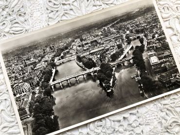
Huge aerial photography of Paris from 1950s
You will can see on the picture (in French): Notre-Dame, le Palais de Justice, la Sainte-Chapelle, l'ancien magasin La Samaritaine, les théâtres du Châtelet, l'Hôtel de Ville de Paris, le Jardin des Plantes, la Gare de Lyon, etc.
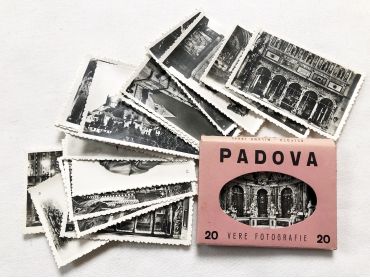
Set of 20 photos of the city of Padua (Italy) in the 1950s.
These photos are typical of the 1950s and 1960s, during which tourism progressed a lot but not all tourists were equipped with a camera. These photos were sold on the tourist sites allowing everyone to keep a souvenir of the visit.
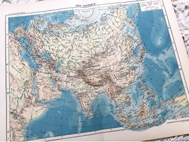
Large vintage map of Asia from a French atlas of the 1910s. This map on two pages measures 46 x 37 cm and forms the front of the document.
These maps show the world as it was in 1910s...
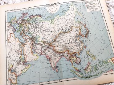
Large vintage map of Asia from a French atlas of the 1910s. This map on two pages measures 46 x 37 cm and forms the front of the document.
These maps show the world as it was in 1910s...
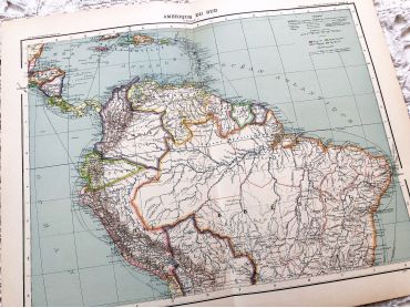
Large vintage map of northern South America (Peru, Surinam, Columbia, etc.) from a French atlas of the 1910s. This map on two pages measures 46 x 37 cm and forms the front of the document.
These maps show the world as it was in 1910s...
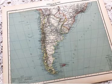
Large vintage map of southern South America (Chili, Brazil, Argentina) from a French atlas of the 1910s. This map on two pages measures 46 x 37 cm and forms the front of the document.
These maps show the world as it was in 1910s...
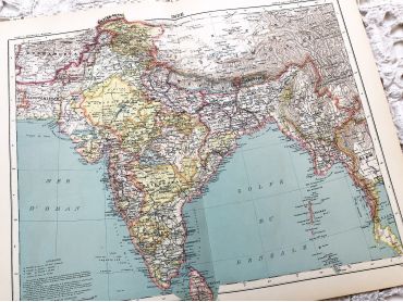
Large vintage map of India and Nepal from a French atlas of the 1910s. This map on two pages measures 46 x 37 cm and forms the front of the document.
These maps show the world as it was in 1910s...
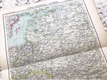
Large vintage map of Western Russia and Romania (and Poland, Bulgaria, etc.) from a French atlas of the 1910s. This map on two pages measures 46 x 37 cm and forms the front of the document.
These maps show the world as it was in 1910s...
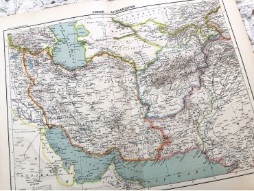
Large vintage map of Persia and Afghanistan (Iran, Iraq, Arabia, etc.) from a French atlas of the 1910s. This map on two pages measures 46 x 37 cm and forms the front of the document.
These maps show the world as it was in 1910s...
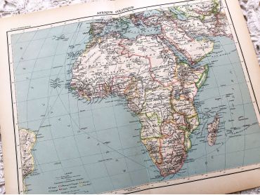
Large vintage map of the political Africa from a French atlas of the 1910s. This map on two pages measures 46 x 37 cm and forms the front of the document.
These maps show the world as it was in 1910s...
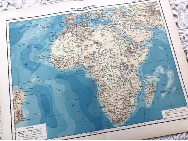
Large vintage map of Africa from a French atlas of the 1910s. This map on two pages measures 46 x 37 cm and forms the front of the document.
These maps show the world as it was in 1910s...
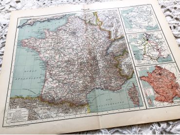
Large vintage map of France from a French atlas of the 1910s. This map on two pages measures 46 x 37 cm and forms the front of the document.
These maps show the world as it was in 1910s...
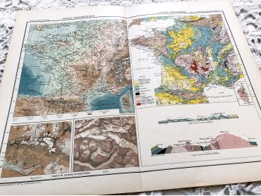
Large vintage map of France geological and hypsometric from a French atlas of the 1910s. This map on two pages measures 46 x 37 cm and forms the front of the document.
These maps show the world as it was in 1910s...
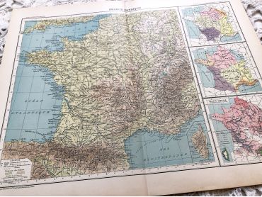
Large vintage map of France physical and administrative from a French atlas of the 1910s. This map on two pages measures 46 x 37 cm and forms the front of the document.
These maps show the world as it was in 1910s...
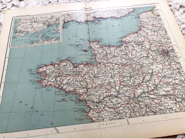
Large vintage map of north-west of France and Brest harbor from a French atlas of the 1910s. This map on two pages measures 46 x 37 cm and forms the front of the document.
These maps show the world as it was in 1910s...
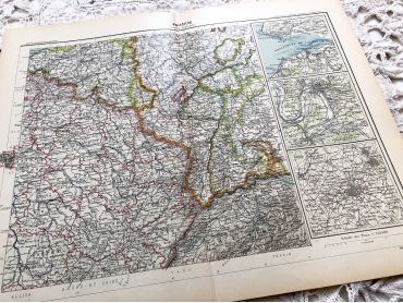
Large vintage map of the north-east of France and the cities of Rouen, Lille and Le Havre from a French atlas of the 1910s. This map on two pages measures 46 x 37 cm and forms the front of the document.
These maps show the world as it was in 1910s...
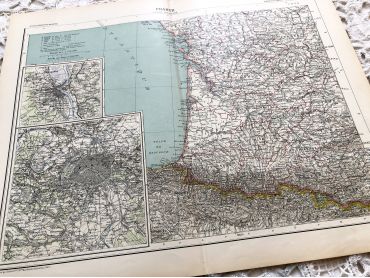
Large vintage map of South-East France and the cities of Paris and Bordeaux from a French atlas of the 1910s. This map on two pages measures 46 x 37 cm and forms the front of the document.
These maps show the world as it was in 1910s...
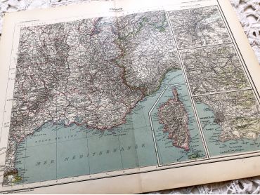
Large vintage map of south-east of France, Corsica, and the cities of Marseille, Lyon from a French atlas of the 1910s. This map on two pages measures 46 x 37 cm and forms the front of the document.
These maps show the world as it was in 1910s...
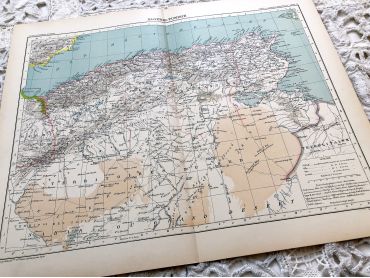
Large vintage map of Algeria and Tunisia from a French atlas of the 1910s. This map on two pages measures 46 x 37 cm and forms the front of the document.
These maps show the world as it was in 1910s...
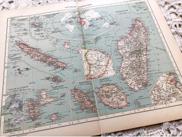
Large vintage map of the French colonies in 1910 (as Martinique, Guadeloupe, Guyane, etc.) from a French atlas of the 1910s. This map on two pages measures 46 x 37 cm and forms the front of the document.
These maps show the world as it was in 1910s...
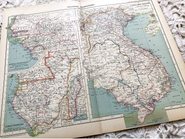
Large vintage map of French colonies in Africa and Asia in 1910 from a French atlas of the 1910s. This map on two pages measures 46 x 37 cm and forms the front of the document.
These maps show the world as it was in 1910s...