Large vintage map of Sweden, Norway and Denmark from a...
Large vintage map of Sweden, Norway and Denmark from a French atlas of the 1910s.
These maps show the world as it was in 1910s...
There are 132 products.
Active filters
Large vintage map of Sweden, Norway and Denmark from a French atlas of the 1910s.
These maps show the world as it was in 1910s...
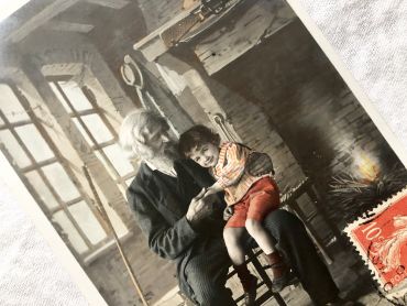
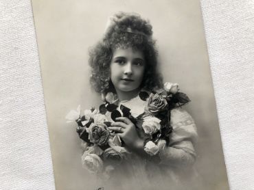
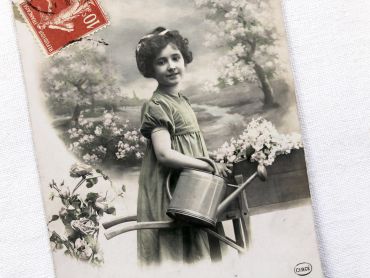
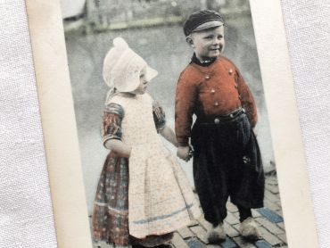
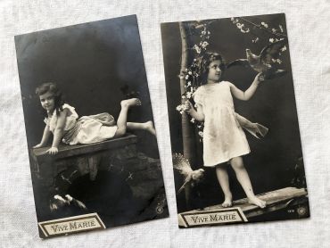
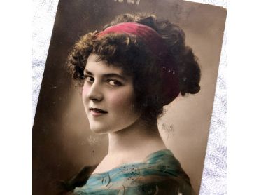
Very beautiful portrait of a young girl - Belgian printed postcard from 1910s.
Beautiful postcard "The Art of Being a Grandfather - Dandling" - Postcards sent in 1905
French religious image by Bouasse-Lebel & Soufflot representing the Last Supper by Leonard de Vinci
4 French postcards of the castle of Meillant from 1930s
6 French postcards of the Chantilly and Cheverny castles in France from 1930s
Large French postcard of the beach of Trouville-sur-Mer in the 1910s
3 French postcards of the city of Marrakech in Morocco from the 1930s
4 beautiful postcards with reproductions of landscape paintings from 1910s
French postcard with a daughter carrying a bunch of roses from 1910s.
Postcard legend: "Vive Marie" / "Long live Mary"
France postcard with a girl carrying a watering can from 1910s.
English postcard with an illustration of Mabel Lucie Attwell from 1930s
English postcard with an illustration by Millicent Sowerby from 1910s
Belgian postcard - Reproduction of a painting by the artist Ethel Parkinson from 1910s
Belgian postcard of a group of children playing around a duck pond from 1910s
Belgian postcard of a little girl holding a little boy by the side of a canal from 1910s
Large vintage map of Mexico from a French atlas of the 1910s. This map on two pages measures 46 x 37 cm and forms the front of the document.
These maps show the world as it was in 1910s...
Large vintage map of the United States of America from a French atlas of the 1910s. This map on two pages measures 46 x 37 cm and forms the front of the document.
These maps show the world as it was in 1910s...
Large vintage map of United States of America from a French atlas of the 1910s. This map on two pages measures 46 x 37 cm and forms the front of the document.
These maps show the world as it was in 1910s...
Large vintage map of North America from a French atlas of the 1910s. This map on two pages measures 46 x 37 cm and forms the front of the document.
These maps show the world as it was in 1910s...
Huge vintage map of North America from a French atlas of the 1910s. This map on two pages measures 54 x 41 cm and forms the front of the document.
The back consists of a map of the northern part of South America (41 x 27 cm) and a map of major gold-producing regions in Africa in 1910s (41 x 27 cm) as shown in the last two photos.
These maps show the world as it was in 1910s...
Two wedding announcement cards for the same wedding (dateless, maybe 1930s).