4 French religious cards - First communion cards from...
4 French religious cards - First communion cards from 1930s and 1960s
Price
€4.00
There are no more items in your cart

There are 66 products.
Active filters
4 French religious cards - First communion cards from 1930s and 1960s
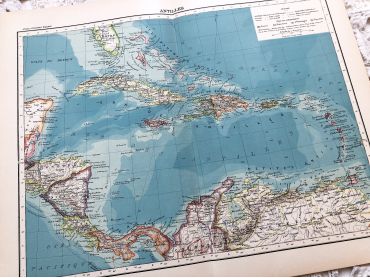
Large vintage map of the West Indies from a French atlas of the 1910s. This map on two pages measures 46 x 37 cm and forms the front of the document.
These maps show the world as it was in 1910s...
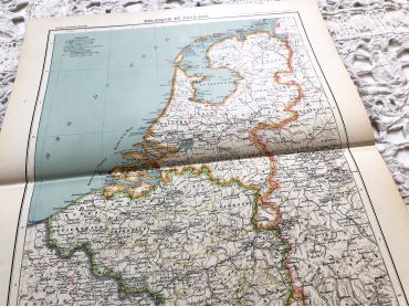
Large vintage map of The Netherlands from a French atlas of the 1910s. This map on two pages measures 46 x 37 cm and forms the front of the document.
These maps show the world as it was in 1910s...
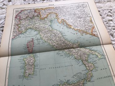
Large vintage map of Italy in 1910 from a French atlas from the 1910s. This map on two pages measures 46 x 37 cm and forms the front of the document.
These maps show the world as it was in 1910s...
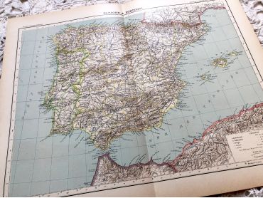
Large vintage map of Spain and Portugal in 1910 from a French atlas of the 1910s. This map on two pages measures 46 x 37 cm and forms the front of the document.
These maps show the world as it was in 1910s...
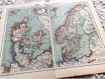
Large vintage map of Sweden, Norway and Denmark from a French atlas of the 1910s.
These maps show the world as it was in 1910s...
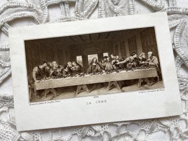
French religious image by Bouasse-Lebel & Soufflot representing the Last Supper by Leonard de Vinci
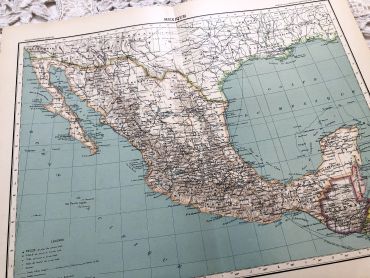
Large vintage map of Mexico from a French atlas of the 1910s. This map on two pages measures 46 x 37 cm and forms the front of the document.
These maps show the world as it was in 1910s...
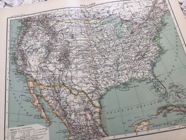
Large vintage map of the United States of America from a French atlas of the 1910s. This map on two pages measures 46 x 37 cm and forms the front of the document.
These maps show the world as it was in 1910s...
Large vintage map of United States of America from a French atlas of the 1910s. This map on two pages measures 46 x 37 cm and forms the front of the document.
These maps show the world as it was in 1910s...
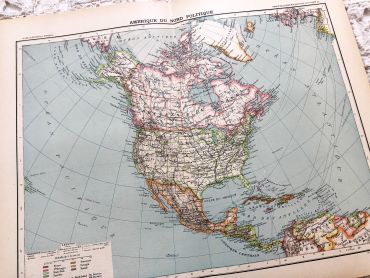
Large vintage map of North America from a French atlas of the 1910s. This map on two pages measures 46 x 37 cm and forms the front of the document.
These maps show the world as it was in 1910s...
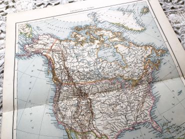
Huge vintage map of North America from a French atlas of the 1910s. This map on two pages measures 54 x 41 cm and forms the front of the document.
The back consists of a map of the northern part of South America (41 x 27 cm) and a map of major gold-producing regions in Africa in 1910s (41 x 27 cm) as shown in the last two photos.
These maps show the world as it was in 1910s...
Beautiful care or beauty product labels - Early 20th century.
Beautiful care or beauty product labels - Early 20th century.
Beautiful care or beauty product labels - Early 20th century.
Beautiful Italian religious card - Card nicely cut from 1910s
Beautiful care or beauty product labels - Early 20th century.
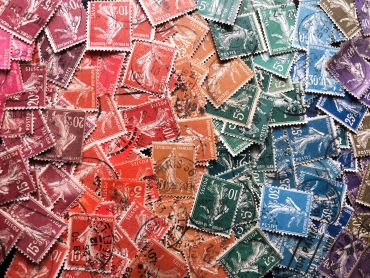
Set of 1000 vintage French stamps from 1900s to 1920s.
This set consists of:
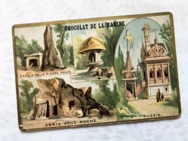
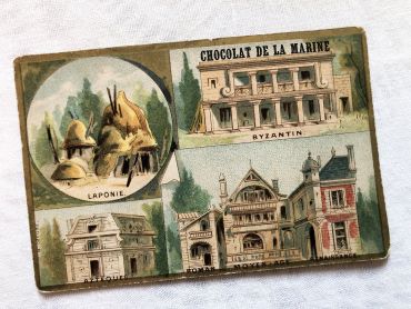
Vintage French chromolithograph of the Chocolat de la Marine brand from 1910s
Vintage French chromolithograph of the Chocolat de la Marine brand from 1910s
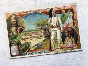
Vintage French chromolithograph of the Liebig brand from 1920s
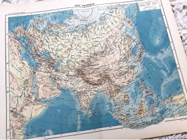
Large vintage map of Asia from a French atlas of the 1910s. This map on two pages measures 46 x 37 cm and forms the front of the document.
These maps show the world as it was in 1910s...
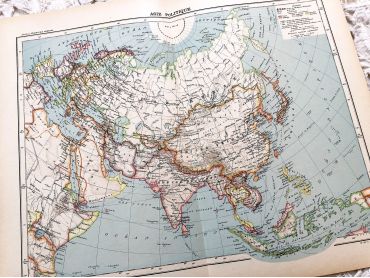
Large vintage map of Asia from a French atlas of the 1910s. This map on two pages measures 46 x 37 cm and forms the front of the document.
These maps show the world as it was in 1910s...
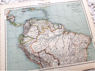
Large vintage map of northern South America (Peru, Surinam, Columbia, etc.) from a French atlas of the 1910s. This map on two pages measures 46 x 37 cm and forms the front of the document.
These maps show the world as it was in 1910s...